and high surface winds imply that sea salt may be the dominant aerosol type under these conditions. ... being the SCOUT-O3 campaign between 15 November.
Click Here
JOURNAL OF GEOPHYSICAL RESEARCH, VOL. 113, D06306, doi:10.1029/2007JD008706, 2008
for
Full Article
Aerosol and trace-gas measurements in the Darwin area during the wet season G. Allen,1 G. Vaughan,1 K. N. Bower,1 P. I. Williams,1 J. Crosier,1 M. Flynn,1 P. Connolly,1 J. F. Hamilton,2 J. D. Lee,2 J. E. Saxton,2 N. M. Watson,2 M. Gallagher,1 H. Coe,1 J. Allan,1 T. W. Choularton,1 and A. C. Lewis2 Received 27 March 2007; revised 9 July 2007; accepted 16 November 2007; published 29 March 2008.
[1] The composition of the planetary boundary layer in regions of deep tropical
convection has a profound impact on the Tropical Tropopause Layer (TTL). The Aerosol and Chemical Transport in tropIcal conVEction (ACTIVE) aircraft campaign was conducted from November 2005 to February 2006 from Darwin, Australia, to characterize the influence of both monsoonal and localized land-based deep convection on the composition of the TTL. This paper summarizes the composition of the potential inflow to such convection in terms of aerosol particle size and composition, carbon monoxide, and ozone, as measured in the lowest 4 km of the atmosphere by the NERC Dornier-228 aircraft during 28 flights in different meteorological regimes over the course of ACTIVE. Six contrasting periods are identified in the boundary layer background as a result of the prevailing meteorology and sources of pollution. The campaign began with a relatively polluted and variable biomass burning season in November, followed by a transition to the monsoon season through December with much less burning. A clean maritime flow dominated the wet-active, and dry-inactive, monsoon period in January; it was followed by a monsoon break period in February, with a return to continental flow and a more premonsoon background state. Deep convective systems, capable of transporting boundary layer air to the TTL, were observed daily outside of the monsoon periods. The chemical composition of submicron aerosols in the premonsoon periods was dominated by a mix of fresh and aged organic material with significant black carbon, well-correlated with carbon monoxide indicating a common burning source, while marine aerosol during the monsoon changed markedly between the wet and dry phases. High concentrations of coarse-mode aerosols were also observed in the monsoon: the clean, marine air masses and high surface winds imply that sea salt may be the dominant aerosol type under these conditions. The climatology presented here will provide a valuable data set for model simulation of chemical and aerosol transport by deep convection in the Darwin region. Citation: Allen, G., et al. (2008), Aerosol and trace-gas measurements in the Darwin area during the wet season, J. Geophys. Res., 113, D06306, doi:10.1029/2007JD008706.
1. Introduction [2] Tropical convection is a crucial issue for climate science for many reasons: Tropical cloud composition (e.g., ice water, liquid water, black carbon) and cloud-top height have profound implications for the Earth’s radiative budget; and fast transport (a few hours) of surface boundary layer trace gases and particles to the upper troposphere affect its composition and chemistry [Dessler, 2002]. The Tropical Tropopause Layer (TTL) is the subject of much ongoing study to reduce uncertainty in climate change predictions and the nature of stratosphere-troposphere ex1
Centre for Atmospheric Science, University of Manchester, Manchester,
UK. 2
Department of Chemistry, University of York, Heslington, UK.
Copyright 2008 by the American Geophysical Union. 0148-0227/08/2007JD008706$09.00
change [Stohl et al., 2003] and consequent impacts on stratospheric ozone [Esler et al., 2001]. Furthermore, aerosol particles lifted from the surface have indirect effects influencing precipitation and radiation fluxes [Lohmann and Feichter, 2005; McFiggans et al., 2006]. For example, the convective uplift of black carbon aerosol generated by frequent biomass burning in the tropics can perturb the radiative equilibrium of the atmosphere; with both the sign and magnitude of the resultant net forcing noted to be highly uncertain and highly dependent on the overall particle composition and position in the atmosphere [Intergovernmental Panel on Climate Change, 2001]. Therefore, a better knowledge of tropical boundary layer composition is implicit in a better understanding of tropical convection and better characterization of the TTL environment. [3] The UK Natural Environment Research Council (NERC)-funded ACTIVE campaign described by Vaughan et al. [2008] was conceived as a comprehensive research
D06306
1 of 19
D06306
ALLEN ET AL.: MEASUREMENT OF THE DARWIN BOUNDARY LAYER
D06306
program of field measurements and modeling work to address these key scientific questions. This campaign took place during the 2005/2006 wet season (November– February) in Darwin, Australia (12.47°S, 130.85°E), and employed two aircraft: the Dornier 228-101 operated by the NERC Airborne Research and Survey Facility, and the Grob G520T Egrett aircraft operated by Airborne Research Australia. Instrumentation on the Dornier measured the aerosol and chemical background of the boundary layer and lower free troposphere between 100 and 4000 m (see section 2), while the Egrett measured cirrus cloud microphysics and outflow from deep convection up to an operational ceiling of 15 km. Furthermore, a total of 35 ozonesondes were launched throughout the campaign from Darwin Airport to provide simultaneous profiles of horizontal winds, pressure, temperature, relative humidity and ozone concentration. [4] ACTIVE was one component of a comprehensive field experiment conducted during 2005/2006 to study TTL composition and clouds in the Darwin region, the other two being the SCOUT-O3 campaign between 15 November 2005 and 8 December 2005 also described by Vaughan et al. [2008] and the Tropical Warm Pool International Cloud Experiment (TWP-ICE) conducted between 21 January 2006 and 14 February 2006. Further aircraft measurements in the TTL, and meteorological measurements in the boundary layer, were conducted by these projects, while radiosondes were launched every six hours as part of TWPICE from a network of locations around Darwin during TWP-ICE. Together, these synergistic campaigns generated an unprecedented data set from which to study tropical deep convection. [5] The Darwin region offers a unique location from which to conduct studies of tropical convection, owing to its proximity to the tropical warm pool around Indonesia and to the Tiwi Islands situated 150 km to the north. Socalled Hector thunderstorms occur almost daily over the Tiwis during the premonsoon and monsoon-break periods between November and February as a result of the strong convergence of warm, moist sea and land breezes [Crook, 2000]. In addition, the annual monsoon flow initiates largescale uplift in the area [Manton and McBride, 1992]. In order to understand the impact on the TTL of these convective influences it is necessary to first understand the composition of the boundary layer and hence the inflow to local convective storms in order to relate observations of the high-altitude outflow with those made in the inflow region. This paper derives representative summaries of gas phase and aerosol size and composition data measured by the NERC Dornier aircraft for various meteorological regimes encountered during ACTIVE. [6] The main sources of aerosol expected around the Darwin area are from biomass burning, the local maritime environment and possible dry soil disturbance, potentially lofting mineral dust. Biomass burning in the northern Australian savanna occurs very frequently throughout the Figure 1. MODIS-derived fire maps of the Australasian region integrated between: (top) 17 and 30 November 2005; (middle) 7 and 12 December 2005, and (bottom) 21 and 30 January 2005. Red areas show active fires. Images courtesy of MODIS Rapid Response Project at NASA/GSFC. 2 of 19
D06306
ALLEN ET AL.: MEASUREMENT OF THE DARWIN BOUNDARY LAYER
D06306
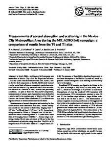
Figure 2. Dornier aerodynamic inlet configuration (Figure courtesy of Andreas Petzold, Deutsche Zentrum fu¨r Luft und Raumfahrt). dry season (June to November) with average annual fuel loadings of up to 9.2 t ha�1 as estimated by Russell-Smith et al. [2003] for the nearby Arnhem Land region during 1999. Fire maps derived using the method described Giglio et al. [2003] and Davies et al. [2004] from the Moderate Resolution Imaging Spectroradiometer (MODIS) instrument on NASA’s TERRA satellite, are shown in Figure 1, which show the prevalence of biomass fires across the Northern Territory in November 2005 (Figure 1, top); and in contrast, an absence of such fires in the region by December (Figure 1, middle) and a continued absence into late January (Figure 1, bottom). Fires in the Queensland region (over 1500 km to the east) are evident at all times throughout the campaign, with greater intensity during November/December than in January/February. [7] Burning emissions in the Northern Territory were extensively studied by the Biomass Burning and Lightning Experiment (BIBLE) campaign described by Kondo et al. [2002], which concentrated predominantly on gas phase emissions and the wider Asian and Indonesian environment, with some observations of aerosols and black carbon [Liley et al., 2002]. The bulk of such burning early in the dry season is initiated by land managers and is relatively low in intensity to remove denser undergrowth that has built up over the preceding wet season. Toward the end of the dry season, fires become more intense as drier fuel sources are consumed. This is particularly the case in Arnhem Land to the east of Darwin, where grassy fuel dries out later in the year compared with the western regions, and is thus prone to fires being started owing to lightning or accident. On any given day, the number and location of fires can vary greatly with background smoke levels between June and September reported to change markedly [Carr et al., 2005] with a tendency toward increasing smoke accumulation and larger particle sizes throughout the period. Hence we expect such burning to influence the local boundary layer for the first weeks of the ACTIVE campaign, when prevailing surface winds were easterly (see section 4).
[8 ] In contrast to the premonsoon, maritime air is expected to dominate during active monsoon episodes, albeit with the potential for mixing of transported continental air masses. To our knowledge, no previous studies of the aerosol background in Northern Australia during the wet season have taken place, a need highlighted by Heintzenberg et al. [2000]. [9] The boundary layer CO burden near Darwin is expected to show a general relationship to the aerosol burden, reflecting the nature of common pyrogenic sources. However, episodic influences of long-range transport of pollutants to northern Australia from sources such as South America and South Africa in austral spring have been reported for CO as retrieved from satellite observations [Gloudemans et al., 2006]. Hence we see that the Darwin boundary layer environment is influenced not only by local sources but also by the governing meteorology and potentially more distant sources of pollution. This paper aims to illustrate this contrast throughout typical meteorological regimes encountered between November and February in the region.
2. Dornier-228: Mission and Instrumentation 2.1. Aerosol and Gas Inlet [10] The Dornier-228 is a light twin-engine aircraft with an interior cabin modified to harbor a scientific payload. Ambient air was sampled through a purpose-built stainless steel, forward-facing, passive, isokinetic inlet positioned over the centre of the cockpit (see Figure 2). The inlet was manufactured by Deutsche Zentrum fu¨r Luft und Raumfahrt (DLR) and based on the aerosol inlet on the DLR Falcon aircraft. Transmission for this inlet is calculated to be 95% at 0.9 mm, 75% at 1.6 mm and 50% at �2.5 mm particle diameter. For further technical information relating to this inlet see Fiebig [2001] and Petzold et al. [2002]. From the main aerosol manifold, two isokinetic subsamples were taken: one branch fed the aerosol spectrometers and a particle
3 of 19
D06306
ALLEN ET AL.: MEASUREMENT OF THE DARWIN BOUNDARY LAYER
D06306
Table 1. Aerosol Instruments Onboard the Dornier Aircraft With Measured Size Ranges Given Where Appropriatea Instrument
Size Range (Diameter)
UHSAS Grimm 1.108 ASP FSSP TSI-1301D PSAP AMS
0.055 – 0.8 mm 0.3 – 25 mm 0.21 – 4.5 mm 0.5 – 32 mm >10 nm 0.04 – 0.7 mm
Filters
-
Technique
Reference/Company
optical scattering optical counter optical scattering optical scattering condensational growth integration plate 70 eV quadrupole mass spectrometry particle deposition
Droplet Measurement Technologies Inc Grimm Technologies Inc Droplet Measurement Technologies Inc Baumgardner et al. [1985] Agarwal and Sem [1980] Radiance Research Inc Jayne et al. [2000]
a
See text for a further description of each instrument.
soot absorption photometer (detailed in section 2.3) on the port side of the aircraft, with the other feeding an aerosol mass spectrometer, a condensation particle counter and deposition filters on the starboard side. Each branch was further split isokinetically to feed the individual instruments. The gas phase instruments were fed from a rearward facing inlet on the main manifold (see Figure 2), while the exhaust from all instruments vented to the aft of the cabin. Transmission and diffusive losses after the inlet were calculated using aerodynamic theory outlined by Baron and Willeke [1993] and were found to be negligible across the size range of particles discussed in this work up to the 50% transmission cut-off diameter of the main inlet (2.5 mm). Hence, transmission losses were dominated by the main inlet for supermicron particles. 2.2. Thermodynamic Instrumentation [11] Temperature, pressure, relative humidity and wind vectors, as well as GPS position and aircraft orientation, were sampled at 20 Hz and recorded at 1 Hz by a Aircraft Integrated Meteorological Measuring System (AIMMS) 20 Hz probe manufactured by Aventech Research Inc. and described further by Beswick et al. [2007]. The probe was positioned on a starboard wing-mounted pod. Typical air speed and aircraft pitch angle on science runs were 75 m s�1 and +4.5°, respectively. 2.3. Aerosol Instrumentation 2.3.1. Number and Size [12] Aerosol particle number size distributions from 55 nm to 32 mm diameter were measured using a range of optical probes (see Table 1). Herein, the terms fine mode and coarse mode aerosol refer to the submicron and supermicron aerosol population fraction respectively. Optical scattering instruments included: (1) a Droplet Measurement Technologies (DMT, Boulder, CO, USA) ultra high sensitivity aerosol spectrometer (UHSAS), measuring dry fine mode aerosol size spectra at 1 Hz (averaged to 1/6 Hz) with a fine size resolution (7.5 nm bins) in the range 55 nm to 800 nm; (2) a prototype DMT aerosol spectrometer probe (ASP), measuring dry aerosol with a resolution between 0.1 and 0.2 mm in the range 0.21 to 4.5 mm; (3) a Grimm Aerosol Technik (GmbH) 1.108 optical particle counter (Ainring, Germany), measuring dry size ranges with a resolution between 0.03 and 0.5 mm in the range 0.3 to 25 mm; and (4) for the coarse aerosol component, a wingmounted forward scattering spectrometer probe (FSSP-100), described further by Baumgardner et al. [1985], measuring ambient particle number size distributions with resolution
0.8 mm from 0.5 to 32 mm. In addition, a TSI-3010D (TSI Inc., Shoreview, MN, USA) condensation particle counter (CPC) measured the total particle number concentration greater than �10 nm. However, absolute number concentrations for sizes greater than 2 mm measured by the ASP and Grimm instruments are not considered here owing to inlet transmission limitations (50% transmission at 2.5 mm). 2.3.2. Black Carbon [13] A Radiance Research Inc particle soot absorption photometer (PSAP) measured black carbon content. For this study, the soot absorption cross section (sae = 8.2 m2g�1) used by Liley et al. [2002] for the geographically similar BIBLE campaign is assumed. To account for high measurement noise, 0.2 Hz PSAP data were smoothed over a fiveminute period. In stable operating conditions the PSAP sensitivity to changes in filter absorption gives a precision of 10�6 m�1, or roughly 0.02 mg m�3 of soot for fiveminute integration. 2.3.3. Composition [14] A Quadrupole Aerodyne Aerosol Mass Spectrometer (Q-AMS) system [Jayne et al., 2000], which sampled air through the main manifold, was used to determine the mass loading of the nonrefractory, non-sea-salt chemical component of submicron aerosol with a high time resolution (30 s). This instrument employs thermal desorption, 70 eV electron ionization, and a quadrupole mass spectrometer. Data were processed and quality assured using the procedures described by Jimenez et al. [2003] and Allan et al. [2003, 2004a] and employed in conjunction with the pressuredependent calibrations and corrections described by Crosier et al. [2006] needed for aircraft operation. Mass concentrations are reported from the Q-AMS (see section 5) for the total nitrate, organic, sulphate and ammonium component masses in the aerosol. Component mass size distributions could not be derived here with sufficient confidence (reasonable signal to noise) owing to the relatively clean environment sampled throughout the majority of ACTIVE flights. 2.4. Gas Phase Instrumentation [15] Gas phase instruments onboard the Dornier are summarized in Table 2 and consisted of the following. 2.4.1. Carbon Monoxide [16] Measurement of CO was performed in-flight using a fast response fluorescence instrument; the AL5002 fast carbon monoxide (CO) monitor (Aero-Laser GmbH, GarmischPartenkirchen, Germany), fitted with a Nafion dryer to remove water vapor. With an integration time of ten seconds, the detection limit was better than 2.0 ppbv. The linearity
4 of 19
ALLEN ET AL.: MEASUREMENT OF THE DARWIN BOUNDARY LAYER
D06306
D06306
Table 2. Gas Phase Instrumentation and Measurement Technique on the Dornier Aircraft Instrument
Technique
Gases
Reference/Company
Aerolaser AL5002 2B Technologies 202 ozone analyzer Automatic tube sampler
fluorescence UV absorption
CO O3
Aerolaser Inc 2B Technologies
absorbent trapping and GC-MS
University of York
Miniature GC
gas chromatography
C5-C10 aliphatics, aromatics monoterpenes, OVOCs halocarbons (Cl, Br, I)
range of the instrument was 0–100 ppmv; well beyond the typical concentrations encountered during ACTIVE. Calibration of the instrument was performed in-flight at various flight levels to allow for the potential effect of ambient pressure changes, using a secondary gas standard containing 73 ppbv ± 5% CO in synthetic air. An additional standard (200 ppbv) was used throughout the campaign to validate the in-flight standard. Data were recorded at one-second intervals. 2.4.2. Ozone [17] Ozone was measured in-flight using a UV absorption detector (2B Technologies). Calibration was carried out prior to deployment using gas phase titration of NO. Data were collected at ten second intervals with an overall uncertainty of 5% (±2 ppbv). Concentration resolution is approximately 1 ppbv. 2.4.3. Volatile Organic Compounds (VOCs) [18] Additional measurements of a range of VOCs were also obtained onboard the Dornier using adsorbent tube samplers and postflight thermal desorption coupled to comprehensive two-dimensional gas chromatography with timeof-flight mass spectrometry (see Saxton et al. [2007] for further details). Calibration was achieved using a 74 component gas standard at 0.1– 2 ppbv levels (Apel Reimer) and uncertainties on single measurements of all VOCs derived by this method are typically around 20% of the determined concentration. Species measured include: isoprene, a-pinene, ethyl benzene, m+p xylene, o-xylene, nonane, isopropyl benzene, 3-ethyl toluene, 1, 3, 5-trimethyl benzene, 1, 2, 4- trimethyl benzene, and 1, 2, 3- trimethyl propyl benzene. Isoprene and a-pinene are not discussed further here owing to their very low atmospheric lifetimes (of the order 1 hour) and high spatial variability (e.g., land/sea contrast) making any overall analysis of their concentration meaningless. 2.5. Flight Operations [19] A total of eleven Dornier science flights and one test flight were carried out in the first phase of the campaign between 13 November and 5 December 2005, of which eight were circumnavigations of the Tiwi Islands to the north of Darwin during the development of Hector-type convection, and three were survey flights of the wider Darwin region (See Table 3 for a summary). A further sixteen flights were conducted in the second phase between 19 January and 14 February 2006, of which three were survey flights of the wider region, four studied the inflow to monsoon convection and a further four measured inflow to Hector systems. [20] Other flights in the second phase included two survey flights to study a monsoon trough inland between Darwin and Alice Springs and a further two flights to sample potentially contrasting air masses toward Indonesia. These four flights are not considered further here as they are
Robinson et al. [2000]
not relevant to the climatological background of convective inflow near Darwin. An additional flight was performed to compare simultaneous measurements alongside the Egrett aircraft (see section 3) for the purposes of instrument intercomparison.
3. Data Quality 3.1. Meteorological Data Quality [21] Meteorological measurements made by the AIMMS20 probe were compared with radiosonde profiles launched from Darwin Airport and additionally with the six-hourly TWP-ICE radiosonde network in January and February. Comparisons of the AIMMS temperature measurements with closely coincident radiosondes gave random differences of ±1°C. Owing to horizontal variability in temperature these differences are not considered significant and no corrections were applied to the data. The instrument manufacturers claim an accuracy of 0.3°C for AIMMS temperature.
Table 3. A Summary of Dornier-228 Missions Throughout ACTIVE Date
Flight Labela
Primary Mission
8 Nov 2005 13 Nov 2005 15 Nov 2005 16 Nov 2005 19 Nov 2005 23 Nov 2005 24 Nov 2005 28 Nov 2005 30 Nov 2005 1 Dec 2005 4 Dec 2005 5 Dec 2005 19 Jan 2006 20 Jan 2006 22 Jan 2006 25 Jan 2006 26 Jan 2006 27 Jan 2006 30 Jan 2006 1 Feb 2006 2 Feb 2006 3 Feb 2006 6 Feb 2006 8 Feb 2006 9 Feb 2006 10 Feb 2006 12 Feb 2006 14 Feb 2006
TD01 TD02 AD03 AD04 SD05 SD06 SD07 AD08 AD09 AD10 AD11 AD12 TD13 AD14 AD15 AD16 SD17 SD18 SD19 SD20 SD21 SD22 AD23 AD24 AD25 AD26 AD27 AD28
instrument test test/Tiwi survey Tiwi survey Tiwi surveyb Tiwi Surveyb inland survey inland survey Tiwi survey Tiwi surveyb Tiwi survey Tiwi survey inland survey test/Tiwi survey monsoon inflow (Tiwis) monsoon inflow (Inland)c Tiwi surveyc inland survey inland surveyc Northern Hemisphere plume survey to Alice Springs survey (return to Darwin) Northern Hemisphere plume Tiwi surveyc Tiwi surveyc Tiwi survey Tiwi surveyc inland survey instrument intercomparison
a First letter of flight label denotes mission type (T, test; A, convective inflow mission; S, wider area background survey), while the second letter signifies the Dornier aircraft. b Coincident with SCOUT-O3 mission. c Coincident with TWP-ICE mission.
5 of 19
ALLEN ET AL.: MEASUREMENT OF THE DARWIN BOUNDARY LAYER
D06306
Table 4. Periods of Meteorological Contrast During ACTIVE Flight Operations Period
Prevailing Influence
Flights Within Period
13 – 19 Nov + 25 – 30 Nov
biomass burning
20 – 24 Nov 30 Nov to 5 Dec 14 – 22 Jan 25 – 27 Jan 4 – 14 Feb
mini-monsoon premonsoon active monsoon inactive monsoon monsoon break
TD02 – SD05 + AD08-AD09 SD06 – SD07 AD10 – AD12 TD13 – AD15 AD16 – SD18 AD23 – AD28
[22] Relative humidity (RH), static pressure and wind data recorded by the AIMMS probe were compared with the sonde data set and with Rotronic HygroClip SC05 temperature and humidity sensors in the AMS sample line. A direct quantitative comparison of AIMMS RH with sondes is limited by the very high natural horizontal variability; however, no systematic differences were noted in November and December and the AIMMS and Rotronic sensors agreed to within 10% (after correcting the latter for the temperature and pressure difference between the atmosphere and inlet line). In the second phase of the campaign, the AIMMS probe was noted to have developed a technical problem due to contamination, with frequently recorded unrealistic RH in excess of 120% and consistent differences of up to 60% between AIMMS and Rotronic sensors. Therefore, RH measurements (corrected for ambient pressure and temperature) recorded by the Rotronic sensor are used for all Dornier flights in the second phase of ACTIVE. [23] General agreement in horizontal wind direction and wind speed was found between radiosondes and AIMMS, and AIMMS pressure was noted to be highly consistent (to within 1 mb) with sonde profiles of pressure at equivalent altitudes. 3.2. Aerosol Data Quality [24] The multiplicity of aerosol spectrometer instruments with overlapping size ranges in ACTIVE allows good characterization of each instrument and better confidence in the accuracy of quantitative data. Median values of total aerosol number concentration for the Grimm, ASP and UHSAS, in their common size range of 0.3 to 0.8 mm, were calculated for each Dornier flight and compared. [25] The average ratio of medians from each flight between the Grimm and ASP spectrometers was 1.71 ± 0.26 in the first phase of the campaign and 1.58 ± 0.20 in the second phase; therefore we conclude that these two instruments were reasonably consistent with each other throughout the whole campaign, in that neither instrument developed a significant drift in sensitivity. However, the UHSAS developed a technical fault after the end of the first phase of ACTIVE and its data are considered unreliable for the later period. The Grimm and ASP worked correctly throughout the campaign, so owing to its greater spectral size resolution, the fine mode aerosol number concentrations reported in this work are taken from the ASP instrument. Differences between the instruments in the first phase serve here as an indication of the inherent uncertainties in using optical probes; variations in particle shape and (com-
D06306
plex) refractive index can result in ambiguities in the scattering properties of the aerosol under investigation [Liu and Daum, 2000]. [26] For the AMS, a collection efficiency of 0.5 was used, typical of the value obtained through comparisons with other instruments in the field [Allan et al., 2004b; Takegawa et al., 2005]. This was validated through a comparison between the integrated UHSAS total particulate volume and the summed AMS and PSAP particulate volume measurements, assuming a density of 1.77 g cm�3 for inorganic aerosol and 1.2 g cm�3 for organics, as derived by Cross et al. [2007]. Average ratios of UHSAS integrated volume to summed AMS and PSAP volumes were in the range 0.4 to 0.7. 3.3. Gas-Phase Data Quality [27] Carbon monoxide and ozone measurements onboard the Dornier were compared with instrumentation on the Egrett aircraft during purpose-flown intercomparison flights where both flew in formation. One such flight was performed in each measurement phase. Carbon monoxide differed by 10 ppbv at most between the two aircraft’s instruments so we take 10 ppbv as the uncertainty on CO data and note that the interseasonal variability measured during ACTIVE greatly exceeds this. [28] A comparison for ozone in the first phase was not possible owing to a failure of the Egrett ozone instrument. A flight intercomparison in the second phase showed that the Dornier ozone instrument measured more than the Egrett’s by �7 ppbv. However, problems were noted with the Egrett instrument due to systematic differences in measured concentration between ascent and descent. Dornier ozone profiles were also compared with ozonesondes launched from Darwin Airport (where available). Although differences of up to 10 ppbv were observed on flights where measured spatial variability in ozone was high, with the Dornier tending to read less than the sondes on average, much of this is expected to be due to naturally high horizontal variability. On flights where little spatial variability was observed in the Dornier data, and the PBL ozonesonde profile varied smoothly with altitude, differences were much smaller (