Brisbane November 2010. 347. MAGICian ..... custom software to provide wireless mesh functionality. .... been proven in the development of automotive ...
Land Warfare Conference 2010
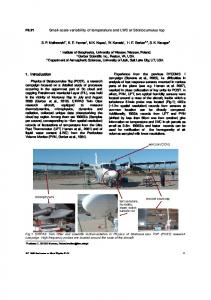
Brisbane November 2010
MAGICian A. Boeing, A. Morgan, D. Powers, K. Vinsen, T. Bräunl The University of Western Australia, Flinders University, Edith Cowan University, Illiarc, Thales Australia
ABSTRACT The Multi-Autonomous Ground-robotic International Challenge (MAGIC) is an intelligent surveillance and reconnaissance mission in a dynamic urban environment aimed at developing autonomous multi-robot systems. The Australian MAGICian team have assembled a multidisciplinary team from a number of leading industry and research institutes to enter the MAGIC challenge. Our approach leverages our team’s skills in Artificial Intelligence, Robotics, Computer Vision, Signal Processing, Autonomous Agents and Multi-Agent Systems, Human Computer Interfaces and Systems Engineering in order to deliver a well engineered autonomous solution. identifying and tracking objects of interest. The disruptor robots had the additional requirement of neutralisation of a target via a laser pointer.
1. Introduction MAGIC is a traditional “systems of systems” integration challenge. Our team first had to produce vehicles that successfully integrated hardware (sensors, vehicle platform) and software (planning, team coordination) into a cohesive unit capable of meeting the challenge's requirements and then implement communication and coordination strategies for the group of vehicles to work as a collaborative team for a number of tasks. In particular, MAGIC is focussing on minimizing the human interaction in controlling our fleet of heterogeneous ground robots whilst completing the challenges.
The primary focus of the challenge was that all tasks be performed with the minimum of human intervention whilst providing a maximum of controller information. Thus the robots were required to perform autonomous navigation and mapping, data fusion and automated multi-agent coordination and planning. They also had to be robust enough to meet the competition requirements and able to operate in a noisy environment [1]. Intuitive, simple and timely HumanComputer interactions were also of a key concern to allow the operators to control the team of robots with minimal intervention, breaking the one-robot one-operator paradigm.
The robotic hardware had to be capable of manoeuvring on a variety of surfaces, maintaining communications with team members and the base station, avoiding obstacles, detecting landmarks, and
347
Land Warfare Conference 2010
Brisbane November 2010
the Object Modelling Group. DDS is a realtime publish/subscribe middleware for distributed systems providing important infrastructure services. DDS is currently being used as part of the US Navy Open Architecture Computing Environment.
2. Conceptual Solution 2.1 Hardware The MAGICian team employed a set of versatile heterogeneous robots. These included light “scout” vehicles and heavy “ranger” vehicles. Scout Sensor Unmanned Ground Vehicles (UGV) were designed to be light but robust and able to negotiate ramps and gutters with ease, as well as the widest variety of terrains. The Scout vehicles were equipped with multiple cameras and structured light ranging solutions, wireless communications, solar panels, and low power computer control. All components and peripherals were packaged as interchangeable modules, four per scout. Scouts were intended to operate in pairs but could be deployed separately. They were designed to be able to look around corners with their compass point camera and mirror arrangements. Scout UGVs had the primary responsibility for exploring and mapping, and usually escorted a Disruptor UGV (DUGV), with their overriding responsibility to protect the DUGV.
There were five key tasks the software had to address: Team planning and coordination, Searching (Exploration and Patrolling), Tracking, Mapping, Navigation and interfacing with the operators. Each of these tasks was achieved with efficient, proven, fault-tolerant approaches. The robots followed search patterns to locate areas to explore and map, or to patrol to locate mobile OOI. During searching or mapping any potential OOI that was found caused the robot to engage in object tracking and identification behaviour. Any OOI located caused the robot to communicate its discovery to its team mates and formulate a plan to neutralise the object. Multi-agent systems poved to be effective in solving autonomous team coordination and planning tasks. The exploration and patrolling tasks were solved using global and local influence maps and sweeping frontier based exploration. These were standard approaches that have been employed by all the MAGICian research groups.
The Ranger vehicles were versatile allterrain platforms that can operate as Sensor UGVs (SUGV) or Disruptor UGVs, depending on their payload. The SUGVs included vision, GPS/IMU, and LIDAR systems for identifying and tracking mobile OOI at long range (>20m), providing early warnings and allowing neutralization from a considerable distance. They contained high performance computing and wireless relay equipment to extend the effective range of the frontline units.
Objects of interest were tracked using standard LIDAR and Computer Vision template-based feature tracking approaches. Mapping was solved through Multi-Agent particle-filter based Simultaneous Localization and Mapping (SLAM). Our system contains two maps, a physical map and an influence map (location of hostile OOI, explored and unexplored regions, UGVs history of time-stamped locations, GPS/ WiFi connectivity, etc) for determining behaviours and a structural map containing information about the environment (locations of buildings, doors, etc) for navigation.
2.2 Software The MAGIC challenge required systems-ofsystems software integration. This was achieved by using a Service Oriented Architecture (SOA) using the Data Distribution Service (DDS) standard from
348
Land Warfare Conference 2010
Brisbane November 2010
Navigation was performed by building potential field maps using proven pathplanning approaches, collision detection for collision avoidance, and the influence map to avoid undesirable encounters with hostile OOI. The driveable region was determined from LIDAR and stereo vision.
for global distribution. The conceptual solution and heuristic strategy outlined here aimed to systematically and efficiently solve the mapping and neutralization tasks in the minimum possible time whilst maintaining as a higher priority the safety of the vehicles.
The primary focus of our solution was maximizing the autonomy of the individual UGVs as well as the coordination of groups and subgroups of UGVs. The operator interface at the GCS consisted of informative displays indicating the current system state and allowed operators to provide input. The most effective interactions were determined using simulated evolutionary techniques and the cognitive load and situation awareness were evaluated using proven psychological and neurological measures.
3. Systems Architecture The robots contain a number of sensors to aid in navigation, mapping and object identification. The robots were equipped with LIDAR sensors to detect obstacles, perform mapping tasks, and assist with detecting moving objects of interest. Vision sensors were used to identify and track OOI, and also to assist in obstacle identification. Each robot determined its pose from its knowledge of the environment, as well as from a fusion of Inertial Measurement sensors, GPS, wheel encoders and a digital compass. Communication took place with modified 802.11 hardware.
Throughout all of these areas sensor and data fusion techniques were employed to ensure reliable data at all levels. Robots continuously broadcasted any new mapping, pose, and OOI information they obtain to the other Ranger UGVs and GCS
Figure 1 Sensor processing system The software employed a multi-agent data fusion system modelled on a Belief-DesireIntention software architecture. The software employed the robot’s sensors to construct a model of its state, the surface, the OOI, and the environment. These models were then used to update the beliefs
of the robots capabilities, and the two maps (a physical map and an influence map). The behaviour control and capability control systems were then coordinated to provide motion and communication outputs that allowed the robots to achieve their goals.
349
Land Warfare Conference 2010
Brisbane November 2010
The block architecture and sensor processing system are shown in Figure 1.
determined what the goal of the vehicle currently had.
From an initial high-level view of the Ranger prototype the following conceptual services were identified:
• Video Management: Received the global and local maps, as well as video features. It generated a pointcloud and determined the position and velocity of the vehicle.
• Vehicle Controller: Received a trajectory plan from the path planner and vehicle synthesis information and created and executed a movement plan.
• Collision Avoidance: Received a pointcloud of objects and the id's of OOIs in the vicinity, and generated a distance map for the vehicle.
• OOI: Provided an interface with the LIDAR and video cameras and broadcasted an id and position of an OOI or Region of Interest.
• Landmark Detection: Received video and land features and local maps as well as distances of these landmarks, and generated a new local map for the vehicle.
• LIDAR: Provided an interface with the LIDAR (long and short) range equipment and broadcasted distances and land features.
• Map Generation: Provided interface with the SLAM; received local maps OOI ids, video and land features and an influence map, it generated a new local map with updated features.
• Vehicle Management: Received position and heading information and coalesced the information into consistent vehicle synthesis data for other services. It also interacted with the Inertial Navigation Unit to ensure that the vehicle's position was always known even when a GPS signal was lost.
4. Ground Vehicle Components and Systems
• Path Planner: Received vehicle synthesis messages and the desired goal from the goal services and used the local map to determine the optimal trajectory for the vehicle.
The MAGICian team consists of two ground vehicle platforms, the Ranger robot developed by the Western Australian team members and the Scout robot developed by the South Australian team members. Both robot types are shown in Figure 2.
• Goal Planner: Given the global and local maps and the vehicle's current state, it
Figure 2 WA ‘Ranger’ robot and SA ‘Scout’ robot
350
Land Warfare Conference 2010
Brisbane November 2010
Ethernet and 802.11n WiFi, contributing another 5W. A Beagleboard+Cerebot 32MX4 servo board provided control. Logitech QuickCam Pro’s were packaged with an internal Class 2 laser on the Disruptor and a Class 2 9-laser array for ranging.
4.1 Scout and Protector UGVs Scout UGVs were a rugged lightweight Sensor UGV design that could negotiate 10cm steps with a payload of up to 2.5kg (total weight 8kg). The design mapping speed was 3.6km/h (1m/s) that matched well with the expected mapping resolution. Level and 1:4 (~15°) incline speed was up to 6km/h allowing the Scout UGV to escape from hostile OOI and 1:4 incline negotiation has been demonstrated at full payload.
A variant on the Scout, the ‘Protector’, used the same chassis and similar payload. They were intended to provide protection to two Scout SUGVs and one Disruptor UGV by providing early warning of approaching hostile or non-combatant mobile OoI. In addition they recognized and tracked hostile mobile OoIs (HOoIs) at over 25m from their detection and lethality zones, and could thus participate in a neutralization from a considerable distance, providing redundancy and protection against interference in conjunction with a pair of such Scouts. The SA Disruptor designator was achieved by building a laser into the PT head of a Logitech Sphere, providing considerable flexibility in designation. Both Spheres of Protector designs were modified when converting to a Disruptor, so a single Disruptor could simultaneously designate two targets.
The scout had 360° camera coverage at up to 30fps, as well as stereo vision, structured light and LIDAR ranging at the 8 (45°) compass points at the same framerate, giving it a resolution exceeding 80px/m at 6m at up to 30fps. At 5fps this resolution increases to over 200px/m at 6m. They were designed to be able to look round corners with their compass point camera and mirror arrangements. This allowed the Scout to assist in mapping and object tracking and neutralization activities. The scout was based on a dual RS540 1/8 scale Remote Control Rock Crawler modifed with the addition of rear steering and a servo-actuated parking-brake. It carried up to a 8kg payload including: 4 50Wh LiPo batteries, Razor 9DoF Inertial Motion Measurement Unit, FSA03 GPS unit, 4 CPUs (1 FIT-PC2i with 802.11bg and DLink DWA-160 for 802.11abgn, 2 FIT-PC2 with 802.11bgn, Cerebot), a DLINK DIR-1522 or 855 Access Point (for 802.11abgn on 2.4 and 5GHz alternately resp. concurrently), and 6 Logitech cameras (4 C905 with side mirrors, enabling continuous 360° low resolution coverage at 25fps, and 2 Sphere PT cameras enabling 360 high resolution coverage at 10fps by panning).
A lighter weight FastScout based on the Lynxmotion A4WD1 was tested too. It had a reduced payload including only 2 FITPCs/Z530s) and was designed for fast deployment and provision of wireless relay services based on the NEPSi protocol [2], as well as long range monitoring of enemy movements and detection of incursions by hostiles into swept areas.
4.2 WAMBot The WA Ranger robot was based on the Pioneer AT3. It is equipped with SICK LMS 111 LIDAR scanners for mediumrange operations, and Hoyuku laser scanners for short range operations. The robots include: a GPS, a digital compass, wheel encoders and an IMU for navigation tasks. The robot was equipped with a
The computational power was provided by 3 Atom Z530 processors at 5W, each controlling two USB cameras, with Gigabit
351
Land Warfare Conference 2010
Brisbane November 2010
Logitech Sphere PT camera for identifying and tracking objects of interest, and a stereo camera system for detecting obstacles, determining the drivable surface and object recognition. All computing was performed on a set of high performance PC laptops with 802.11 WiFi/ethernet router using custom software to provide wireless mesh functionality.
measurements for collision avoidance, and was interfaced directly via USB. A Disruptor based on the Pioneer platform was acheived by substituting Logitech Sphere cameras modified by the SA team to include a laser designator.
5. UVS Autonomy and Coordination Strategy
The PIONEER 3-AT was a highly versatile all-terrain robotic platform, with 252 watthours of hot-swappable batteries providing up to six hours of charge. The WA team added an additional set of batteries and chargers enabling continuous operation. The platform measured 50cm x 49cm x 26cm and had a solid aluminium body with 21.5cm wheels enabling all-terrain operation. The P3-AT's powerful motors and four monster wheels could sustain 2.8 km/h over a variety of rugged terrain, enabling it to climb a 45% grade, and could carry a payload of up to 30 kg. The P3-AT base already came with a set of standard software functionality that has been extended over the years by the UWA/EECE Robotics&Automation lab.
All MAGICian units were autonomous in the sense that they prioritized and chose an action without requiring operator intervention. Multi-agent systems proved to be effective in modelling the interactions in large complex systems that involved multiple self-interested entities. To facilitate UGV communication and coordination at any time during the challenge, we needed to be able to find the agent, know its capabilities (eg: neutralising), and affect its decision-making should any manual intervention become desirable. Manual intervention included selecting sweep patterns, overall strategies, or target confirmation. We addressed the following aspects using existing proven technologies as a starting point, and improving them to suit the challenge as we developed:
The P3-AT robot included 100 tick encoders with inertial correction enabling dead reckoning and compensation for skid steering. The WA robot also contained a Vector 2X digital compass and used the stereo cameras for additional motion estimation allowing more precise pose estimation. The robot was also equipped with a MEMsense IMU/Gyro enabling further data fusion for determining the robot's pose when GPS was not available.
•
System level UGV management
• High level UGV communication and task coordination •
Individual UGV
Figure 3 illustrates the overall Searching and Mapping operation. This covers exploration, which involved navigating to an unmapped region, and mapping the region with SLAM. Patrolling/Discovery involved searching an already mapped area for an object of interest or resource. During these tasks an object of interest may be detected which triggers the object identification and tracking behaviours, as illustrated in Figure 4.
The SICK LMS 111 compact outdoor LIDAR provided high-resolution, highaccuracy planar range data, reliably detecting objects up to 18m away and was used in mapping operations. It had an ethernet interface to connect directly to the PC. The Hokuyo URG-04LX-UG01 Scanning Laser Rangefinder was angled towards the ground and provides distance
352
Land Warfare Conference 2010
Brisbane November 2010
• UGV Agent: In addition to the programs that conducted low-level sensor input analysis and actuator control, each UGV had a software agent that was goal oriented and responsible for high-level representation of its capabilities, resolving conflict goals, selecting plans based on the context and communicating with other agents when necessary. • Personal Assistant Agent for Human Operators: To maximise the interoperability, each human operator sent information and commands via the GCS to the UGVs through their personal assistant agents, which assumed the same agent communication language and the same set of communication protocols to ensure unambiguous communication.
Figure 3 Search and Mapping Operations
5.1 Mapping and Patrolling At the system level, the Personal Assistant agent maintained an up-to-date Physical Map as well as an Influence Map. A standard influence map contained data regarding the location of hostile and friendly units allowing the identification of safe areas, dangerous areas, and conflict points. Our influence maps differed from the standard approach in that ours not only stored information of the dangerous enemy zone, it also had layers of information describing numerically where the desirable zone was for each of the team tasks. For example, in terms of mapping, an unexplored area would be more desirable than a fully mapped area. The Influence Map was also time based, so if an area had not been checked for a long time it would have a higher priority for patrolling behaviours. Individual agents would also maintain a local influence map. Therefore, the influence map serves as a data source for team level and individual level decision making, which is especially useful in determining patrol strategies. Maps were available in machine representation for use by UGVs as well as overlay and view formats for operators.
Figure 4 Tracking Behaviour The tracking behaviour involved locating a target by focusing the appropriate sensors on the region of interest and identifying the object with object recognition routines. If the object was a mobile object a following behaviour was executed in parallel. During the tracking of one OOI another OOI may come into view, requiring the parallel detection of additional regions of interest. The follow behaviour required navigation which was broken down into obstacle avoidance, hostile avoidance and path planning activities. The decision of which behaviour to activate was determined by a set of interacting agents:
353
Land Warfare Conference 2010
Brisbane November 2010
robot navigation and collision avoidance for a number of platforms. Our approach used cameras to determine a ground plane to identify a driveable area, this approach has been proven in the development of automotive lane-change assistance by the WA team. This data was fused with information from the short range distance sensors to determine likely obstacles and modify the robots trajectory. The robot path was generated from the mapping information using a progressive realtime path planning implementation.
5.2 Exploration The exploration of an unknown space used a Multi-Robot Frontier-Based Exploration approach. This technique is based on the concept of frontiers, the boundary between explored and unexplored space. Our robots used a combination of "exploration groups" and pattern matching algorithms. Exploration groups were based on vehicles that were geographically close. These groups then coordinated their frontier selection to minimise the wasted effort that could arise from multiple vehicles selecting the same frontier. Pattern matching algorithms used experience from previous operational scenarios to determine the ideal exploration trajectories.
5.5 Coordination Protocols Coordinating a group of vehicles to work together as a team is an area in which our team has extensive expertise from RoboCup and FIRA competitions, Ant colony optimization tasks and from industry work. We used a Market-Oriented-Programming (MOP) approach to the team coordination tasks. Participants in a MOP system may only offer to buy or sell quantities of a commodity at a fixed price. MOP techniques have been shown to solve distributed resource allocation problems effectively.
5.3 Tracking Object tracking was a very difficult problem due to abrupt object motion, shadows, camera motion, and object occlusion. Our team had existing robust visual object tracking systems from previous work, such as, identifying overtaking vehicles for automotive applications. Our approach involved colour and template-based object tracking from regions of interest identified by the LIDAR and vision sensors. These classifiers were combined to provide fused responses using boosting techniques. As the operator confirmed OOI, these systems were configured towards favouring falsepositives rather than missing identifications. Kinematic models of moving objects were maintained to enable tracking of occluded or shadowed OOI, coupled with standard state estimation techniques. These models were globally shared in the physical map, minimizing the likelihood of operators needing to re-identify non-combatant OOI and false positives.
A distributed auctioneering algorithm was applied to team coordination tasks. Vehicles wishing to participate in the auction submited their prices for performing the task; the price based on the amount of resources they would need to expend in order to perform the task. This approach has been shown to be fault-tolerant in noisy and dynamic environments, and produced a distributed approximation to a global optimum of resource usage. Some modifications needed to be undertaken due to the different types of tasks that were to be performed (explore, track, neutralise).
5.4 Navigation Navigation was an area of strength for our team. We have extensive experience with
354
Land Warfare Conference 2010
Brisbane November 2010
into our navigation boards on other classes of vehicle, but given urban canyon conditions, accuracy to even 2m with GPS or DGPS was not expected. Thus primary reliance was dead reckoning corrected against UAV waypoints and GPS as available. Our camera-based servo technology increased accuracy for dead reckoning beyond what might be expected from DGPS between UAV mapped waypoints, which will be used to correct drift and GPS error.
6. Sensors, processing and mapping for UGVs All UGVs were fitted with Inertial Navigation System (INS), Wheel Encoders, Cameras, Global Positioning System (GPS) devices, and a Digital Compass. An integrated 6-DOF MEMS IMU, Compass and GPS module has been developed by the Flinders ISE group for this purpose. Position estimates were computed on-board using a dead-reckoning process based on an Extended Kalman Filter or using an Unscented Particle Filter with additional measurement data.
7. Acknowledgements This material is based on research sponsored by the Air Force Research Laboratory, under agreement number FA2386-10-4024. The U.S. Government is authorized to reproduce and distribute reprints for Governmental purposes notwithstanding any copyright notation thereon. The views and conclusions contained herein are those of the authors and should not be interpreted as necessarily representing the official policies or endorsements, either expressed or implied, of the Air Force Research Laboratory or the U.S. Government.
For the Protector UGV, a monocular 360° vision based target detection and tracking system was developed to enable the UGVs to accurately localize themselves within their surroundings. The system used a spinning mirror to allow all-round vision. Images were first deblurred then enhanced using super-resolution reconstruction and finally stitched together to form an allround panorama. Features located within successive panorama frames were used to determine motion from optical-flow and facilitate simultaneous localization and mapping (SLAM) methods from poseestimates. Additional pose information was extracted from measurement data obtained from the LIDAR units. Similar methods have been successfully applied in our Autonomous Underwater Vehicle project, which has no access to GPS below the water surface. In addition, four 7° FoV cameras provided longrange 360° coverage with partial overlap. The standard Scouts were identical except they used 8 static 66° FoV with 21° overlap and stereo+laser ranging.
8. References [1] L.S. Smith, Unsolved military noise, J. Acoust. Soc. Am. 24: 769-772, 1952; [2] Darryl K Sharman and David M W Powers (1999) Hardware System Simulation, pp395-417 in Rajkumar Buyya, Hi Performance Cluster Computing V2: Programming and applications, PrenticeHall
The BU-353 USB GPS receiver was specified for navigation checks on the Scouts, and GPS (plus gyros etc) was built
355