Hydrology and Earth System Sciences, 7(1), 133–146 (2003) EGUdam on the Senegal River Delta wetland (Mauritania) Mitigation of negative ecological and socio-economic impacts of the©Diama
Mitigation of negative ecological and socio-economic impacts of the Diama dam on the Senegal River Delta wetland (Mauritania), using a model based decision support system S. Duvail 1 and O. Hamerlynck 2 1
Centre for Ecology and Hydrology, Crowmarsh Gifford, Wallingford, OX10 8BB, UK
2
IUCN, 28 rue Mauverney, 1196 Gland, Switzerland
Email for corresponding author:
[email protected]
Abstract The delta of the River Senegal was modified substantially by the construction of the Diama dam in 1986 and the floodplain and estuarine areas on the Mauritanian bank were affected severely by the absence of floods. In 1994, managed flood releases were initiated in the Bell basin (4000 ha) of the Diawling National Park, as part of a rehabilitation effort. The basin was designated as a joint management area between traditional users and the Park authority and a revised management plan was developed through a participatory approach based on a t opographical, hydro-climatic, ecological and socio-economic data. Hydraulic modelling was developed as a tool to support stakeholder negotiations on the desired characteristics of the managed flood releases. Initially, a water balance model was developed. The data were then integrated into a one-dimensional hydraulic model, MIKE 11 (DHI, 2000). When associated with a Digital Elevation Model and a Geographic Information System, (Arc View), the model provided a dynamic description of floods. Flood extent, water depth and flood duration data were combined with ecological and socio-economic data. The water requirements of the different stakeholders were converted to flood scenarios and the benefits and constraints analysed. A consensus scenario was reached through a participatory process. The volume of flood release required to restore the delta does not affect hydro-power generation, navigation or intensive irrigation, for which the dams in the basin were constructed. Hydraulic modelling provided useful inputs to stakeholder discussions and allows investigation of untested flood scenarios. Keywords: wetland restoration, water use conflicts, equity, Senegal River delta, Mauritania, Diawling National Park
Introduction Until the 1970s, large dams were promoted as an important means of meeting human needs for water and energy. The World Commission on Dams’ 2000 report, an independent assessment based on case studies from all over the world, has shown that many dams under-performed with respect to intended benefits and delivery of services. Also, the negative environmental and social impacts of large dams were largely unanticipated or under-estimated. By storing or diverting water, dams alter the natural distribution and timing of stream flows. Downstream from a dam, the most common effect is a reduction of the flood peak and, therefore, a reduction of the frequency, extent and duration of floodplain inundation (McCartney et al.,
2000). This reduction in downstream annual flooding may reduce the natural productivity of floodplains and deltas (Bergkamp et al., 2000). The effects are particularly significant for strongly seasonal, flood-related ecosystems such as Saharo-sahelian wetlands. In these systems, where productivity is enhanced by annual flooding and the human uses are regulated by the natural flood calendar, cost-benefit analysis demonstrates that the natural system can be more efficient than the artificial one (Barbier et al., 1997). Furthermore, as these seasonal wetlands are often surrounded by vast low rainfall areas, the wetland production may support the human and animal populations of a much larger region (Adams, 1996). In addition to these environmental and economic effects, 133
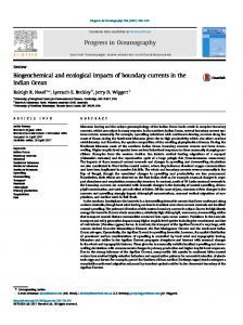
S. Duvail and O. Hamerlynck social impacts are linked to issues of equity. In many cases, large dams are projects where the finance and motivation for their construction come from one group of stakeholders who benefits, while others pay the price in terms of low flows and reduced environmental quality (McCartney et al., 2000). The Senegal iver basin management is an example of the complexity of environmental, economic and social issues linked to dam construction. In the 1970s, in a drought situation, the riparian countries of the Senegal river proposed to solve the food crisis by the introduction of intensive irrigated rice production. They created the “Organisation pour la Mise en Valeur du Fleuve Sénégal” (OMVS) and two major dams were built on the Senegal river (Fig. 1): the Diama dam (completed in 1985) in the delta was conceived to block the dry season influx of sea water into the lower valley. The Manantali dam (completed in 1989) controls the Bafing tributary, which drains high rainfall areas in the Fouta Djalon mountains in Guinea and contributes about 50% of th average runoff in the basin, but up to 70% in drought years (Lazenby and Sutcliffe, 1994). This multipurpose dam was designed to store and subsequently release water for irrigation, navigation and hydropower production. The environmental and social consequences of the whole
project were underestimated (Cowan, 1999; Adams, A., 1999) while the results of the irrigated agriculture have been far below expectations (Crousse et al., 1991; OMVS et al., 1998). These impacts were particularly severe downstream of the dam in the Mauritanian part of the delta. Before the Diama dam was built, the delta was an estuarine ecosystem. Intense evaporation during the dry season (November to June) would cause an inversion of the estuarine gradient with higher salinities upstream, especially from March to June (Baillargeat, 1964). Local livelihoods were strongly dependent on natural productivity: fisheries (Bousso, 1997), livestock keeping and the production of artisanal mats (Hamerlynck et al., 1999). The local economy collapsed after the construction of the Diama dam and especially after the completion, in 1991, of the reservoir embankment, which isolated the former floodplain from the freshwater flood (Duvail, 2001). Because irrigation was originally considered to be the priority, the management protocol of the dam was established without the involvement of the non-agricultural users and, therefore, without consideration of their specific water needs. Between 1990 and 2000, the main purpose of the Diama dam, initially designed as a salt wedge dam, evolved towards the supply of water to the irrigated rice
Fig. 1. Map of Africa, with as inset a map showing the Senegal River Basin with the location of the two large dams. The second inset map shows the Senegal River Delta with the former floodplain, the Diama dam impoundment and the various protected wetlands, including the Diawling National Park.
134
Mitigation of negative ecological and socio-economic impacts of the Diama dam on the Senegal River Delta wetland (Mauritania) fields at minimal pumping cost. The water level of the Diama lake was, therefore, raised progressively (Duvail et al., 2002). In the past ten years, efforts have been made to alleviate the negative impacts of dams (Bergkamp et al., 2000). Actually, some of these adverse impacts are reversible (Hamerlynck et al., 2002) and managed flood releases from the reservoirs can restore downstream productivity. In the Middle Valley of the Senegal River, research led by the Institute for Development Anthropology showed that many of the adverse affects of the upstream dam (Manantali) could be minimised, by maintaining an artificial flood in the Senegal River (Salem-Murdock et al., 1994; SalemMurdock, 1996). Downstream of the second dam (Diama), the restoration project of the Mauritanian delta, had determined a water management scenario to rehabilitate the degraded estuarine and floodplain ecosystems and so reconcile the interests of a diversity of stakeholders. The restoration project started in 1994 within the framework of the establishment of the Diawling National Park (Fig. 1). The project is based on an ecosystem approach, according to which healthy ecosystems are a fundamental requirement for sustainable development (Pirot et al., 2000). By establishing a hydraulic infrastructure, such as sluice gates and embankments, managed flood releases rehabilitated the former floodplain and restored the estuarine environment (Figs. 2 and 3) (Hamerlynck et al., 1999). However, restoring the former floodplain is much more complex than just opening sluice gates. In such an artificial wetland, the managed flood releases have to take into consideration environmental sustainability, economic efficiency and social equity. Practically, the questions were: z z z
how much water to release and when, how to adapt the management to observed and perceived impacts of the artificial flood releases, how to promote equitable access to the restored natural resources and, at the same time, enhance biodiversity. The research objectives were therefore:
z z z
to design, calibrate and validate a model to describe the revised hydraulic functioning of the system, to observe the ecological and socio-economic impacts of the flood releases, to simulate several hydrological scenarios.
The paper describes how the hydraulic modelling was conducted and how the correlations between flood characteristics (flood extent, duration and maximum water levels) and resource abundance and resource use were drawn
on to explore various flood scenarios for one of the protected area’s sub-basins, in the context of joint management of the restored wetland by the Diawling National Park authority and the resource users.
Study area The Bell basin covers approximately 4,000 ha in the centre of the Diawling National Park, a wetland of international importance listed under the Ramsar convention (Fig. 3). It was the first basin to be rehabilitated during the much larger enterprise to restore the floodplains on the Mauritanian bank of the Senegal river by managed flood releases which eventually covered over 40 000 ha (Hamerlynck and Duvail, in press). The basin consists of a low-lying plain of alluvial halomorphic soils which floods when water level exceeds 0.9 m IGN (French ‘Institut Géographique National’ datum which approximates Mean Sea Level) . The plain is crisscrossed by a number of channels, which are at about –0.2 m IGN. A saline groundwater layer exists near to the surface (Nicoud, 1974). In the pre-dam era, the Mréau inflow channel (Fig. 2) connected the basin to the Senegal river and would start flowing with the arrival of the annual flood in August. Through a network of channels, fresh water would flow north, via Berbar to fill the Diawling depression and southwest through the Bell channel, diluting the hypersaline waters of the Ntiallakh. At flood peak, most of the basin would be under water and vast prairies of Sporobulus robustus would develop. Towards the south-west of the basin, the ‘Zait’ depression (Fig. 2), used to fill in years with good floods and supported floating rice Oryza barthii (Baillargeat, 1964). The north-western part of the basin, bordering the Ziré dune, was covered by dense stands of Acacia nilotica (Diawara, 1997). In the post-dam era, the basin became a virtually barren plain with some Tamarix along the former channels and Chaenopodiacea colonising the higher ground (Diawara, 1997). In 1991, the basin was integrated into the newlyestablished Diawling National Park. In contrast with the two other basins in the Park (Diawling to the north and Gambar to the south) (Fig. 3), which were designated as purely conservation areas, management in the Bell basin was undertaken jointly with the local communities. Traditional extractive uses, such as fishing, grazing, gathering of Sporobolus robustus and Acacia nilotica seedpods for mat making, were allowed to continue and even encouraged. In 1994, the Lemer sluice gate, built in the Diama embankment (Fig. 3), became operational and a first managed flood release was tested. Flooding was 135
S. Duvail and O. Hamerlynck
Fig. 2. Map of the pre-dam hydrology of the Lower Delta of the Senegal River.
Fig. 3. Map of Lower Delta of the Senegal River showing the three basins of the Diawling National Park (Diawling, Bell and Gambar).
136
Mitigation of negative ecological and socio-economic impacts of the Diama dam on the Senegal River Delta wetland (Mauritania)
Fig. 4. Water levels in the Bell basin between 1994 and 1999. When the water level exceeds 0.90m IGN the floodplain starts to be covered by water (grey shading).
supplemented from ‘downstream’ through the Bell sluice gate by an emergency water release from the Diama dam which flooded the lower parts of the city of St. Louis (Fig. 1) and destroyed a number of embankments. In 1995, the managed flood release was supplemented by a much larger, but better planned, release from Diama. In 1996, the hydraulic infrastructure of the basin was completed (the Ziré embankment separated it from the Diawling basin, the Bell embankment from the Ntiallakh basin and the Bell1 and Berbare sluice gates were operational) and therefore total control was established over inflows and outflows. In 1997 and 1998, the basin’s channels were used as conduits to bring fresh water to the Ntiallakh basin in April and May, thus avoiding the hyper-salinity which had all but destroyed the mangrove in previous years (Fig. 4). To prevent the colonisation of the channels by reed-mace Typha domingensis, no dry season flooding was practised in 1999 and 2000.
controlling sluice gates (Fig. 5). For the most accessible sites, daily records were obtained; for the more distant ones, recording frequency varied from daily to weekly. In 1997, two drum and stylus data loggers Ott X were installed at the Lemer sluice gate, one upstream (in the Diama reservoir) and one downstream. To establish the rating curves for the different sluice gates, over 35 flow measurements were made using an Ott C31 current meter. Climatological data were obtained from an automatic weather station installed at the National Park Headquarters in 1997, which recorded air and soil temperature, wind speed and direction, rainfall, relative humidity and solar radiation. Evapotranspiration, calculated using the Penman (1948)
Materials and methods Describing the correlations between the hydrological modifications and the responses of both the ecosystems and the socio-economics required an ambitious programme of data collection across various disciplines through a holistic approach. Data were collected primarily during 18 months of intensive fieldwork, spread over flood and dry seasons from 1996 to 1999. Additional data were obtained from the monitoring system set up by the Diawling National Park staff. HYDROLOGY AND HYDRAULIC MODELLING
Data acquisition Water levels relevant to the Bell basin were recorded at six sites upstream and downstream of the inflow and outflow
Fig. 5. Hydro-climatological framework for the Bell basin.
137
S. Duvail and O. Hamerlynck formula, was correlated with ‘class A’ pan records from St. Louis airport weather station in Senegal, about 25 km away. Topographical data were combined from two sources. A 1/20,000 base map, dating from 1985, was available (Bocande and Bouette, 1985). It was established by closed loop traverse using a theodolite. The map gives altitude at points 200 m apart to a precision of 0.1 m. Wind-driven erosion and deposition are strong modelling forces on the salty floodplains which had been dry and without vegetation, except for a few temporary rainfed depressions, throughout the major part of the years 1986 to 1994. Consequently, the morphology of many of the former floodplain channels had altered considerably. Therefore, additional altitude measurements were obtained using Mira Z differential GPS in June 1999, essentially in the channels but also in the depressions and on the floodplains. Simultaneously, altitudes were established, to 0.1 m precision, for all hydraulic infrastructures, stageboards, data loggers, piezometers and a series of wells.
All data were digitised (1340 points) and incorporated into a digital elevation model (DEM) through a kriging method of interpolation on a 50 × 50 m grid, using Surfer software. Storage-elevation relationships were established through a cut-and-fill method. Polynomials were fitted through the data points and drawn as morphometric curves showing water level (in m IGN) versus water surface and water level versus storage. Hydraulic modelling Hydraulic modelling comprised a simple water balance model and a hydrodynamic model (Fig. 6). The water balance models for the basin were established on an Excel spreadsheet using a daily step according to the equation : Qi + P + R – Qo – E – I + ∆ St = 0
(1)
Fig. 6. Framework of the hydraulic modelling. Data collected are shown in the centre between the model boxes. Their use in the modelling is indicated by arrows. The validation arrow in the flood model is shown as a dotted line because no satellite image could be obtained at maximum flood extent.
138
Mitigation of negative ecological and socio-economic impacts of the Diama dam on the Senegal River Delta wetland (Mauritania) with Qi P R Qo
= Daily inflows in m3 at Lemer sluice gate = Daily rainfall for the basin area in m3 = Daily runoff in m3 = Daily outflows in m3 at Bell and Berbar sluice gates E = Daily evaporation in m3 I = Daily infiltration in m3 ∆ St = Daily storage variations in m3 Daily flows for 1997 and 1998 were calculated from instantaneous flows, calculated as in Eqn. (2) (Carlier, 1988; Graf and Altinakar, 2000).
Q = mLO 2 gh with: Q L O h g m
(2)
= inflow in m3 s–1 = section width in m = aperture height in m = hydraulic head in m = 9,78 = hydraulic coefficient (less than 1).
The hydraulic coefficient m for each sluice gate was derived from flow measurements with different apertures and at different hydraulic heads (around 10 measurements for each sluice gate). Rainfall data were taken from the automatic weather station at the Park HQ. Surface runoff is very low because of the general flatness of the basin and the permeability of the sandy soils of the dunes at their edges. It was estimated as 1% of rainfall volume, the same as was used in a study of Lake Bam in Burkina Faso (Ibiza, 1972). Evaporation losses were calculated using data from the class A pan of the St. Louis weather station which correlates with Penman evapotranspiration calculated for the Park Headquarters’ weather station (N=452, R²=0.552, p