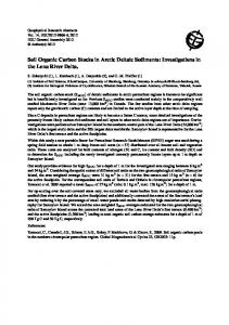
S. E. PULLAN AND J. A. HUNTER .... mum offset" technique (Hunter et al. .... TABLE 1. Fraser delta radiocarbon ages range from 11 920 5 90 BP (TO-1094) just above the .... fans, and peat bogs; dark shading denotes pre-Holocene landmass.
Postglacial deltaic sediments, southern Fraser River delta, British Columbia' JOHNJ. CLAGUEAND J. L. LUTERNAUER Geological Survey of Canada, 100 West Pender Street, Vancouver, B.C.,Canada V6B lR8 AND
S. E. PULLANAND J. A. HUNTER Geological Survey of Canada, 601 Booth Street, Ottawa, Ont., Canada KIA OE8
Can. J. Earth Sci. Downloaded from www.nrcresearchpress.com by Simon Fraser University on 11/09/14 For personal use only.
Received February 1, 1991 Revision accepted April 3, 1991 The Fraser River delta, the largest delta on the west coast of Canada, has been built into the Strait of Georgia during the Holocene. Drill-hole and seismic reflection records reveal a succession of sedimentary units deposited during early Holocene progradation of the delta. These overlie an irregular surface developed on Pleistocene drift. Mud and silt, similar to sediments presently accumulating off the mouth of Fraser River in the southern Strait of Georgia, are conformably overlain by a thick unit of sandy foreset beds, dipping gently to the south-southwest into Boundary Bay and deposited in a foreslope environment. The foreset unit is sharply overlain by a much thinner topset sequence comprising silt and sand deposited in intertidal, fluvialchannel, and overbank environments, and peat deposited in swamps and bogs. Fifteen accelerator mass spectrometry radiocarbon dates on shell and wood indicate that most of the deltaic sediments south of the Main Channel of Fraser River were deposited between ca. 7500 and 5000 BP. By 5000 BP the locus of sedimentation had shifted from the south, into Boundary Bay, to the west and southwest, into the Strait of Georgia proper. Le delta du fleuve Fraser, le plus grand delta de la c8te occidentale du Canada, a CtC CdifiC dans le dttroit de Georgia durant 1'Holoctne. Les donnCes de forage et de sismique rkflexion rkvtlent une succession d'unitts skdimentaires accumulCes durant la progradation du delta ii 1'Holockne prtcoce. Ces unit& recouvrent une surface irrkgulitre dtveloppCe sur le till pltistoctne. Boue et silt, ressemblant aux stdiments qui s'accumulent prtsentement ii l'avant de l'embouchure du fleuve Fraser dans la partie sud du dttroit de Georgia, sont recouverts par une Cpaisse unit6 concordante de couches frontales de sable, faiblement inclintes vers le sud-sud-ouest dans la baie de Boundary, sCdimentks sur la pente vers l'aval. Cette unit6 de couches frontales se distingue nettement d'une mince skquence sus-jacente de couches sommitales de silt et de sable accumultes dans des milieux intertidal, fluvial et d'inondation; des dCp8ts de tourbe se sont formCs dans les markcages et tourbitres. Les Lges au radiocarbone, dCterminCs par spectroscopie de masse accClCrCe, de 15 tchantillons de coquillage et de bois indiquent que la majorit6 des sediments deltdiques au sud du chenal Main du fleuve Fraser date entre 7500 et 5000 Av.P. Autour de 5000 Av.P., le centre de ~Cdimentationa migrC du sud, dans la baie Boundary, vers l'ouest et le sud-ouest, dans le dCtroit de Georgia lui-mCme. [Traduit par la rkdaction]
Can. J. Earth Sci. 28, 13861393 (1991)
Introduction The Fraser River delta, south of Vancouver, British Columbia (Fig. I), is the largest and most important delta on the west coast of Canada. It is an important agricultural and waterfowl area and a vital link in the Fraser River salmon fishery; it is also an area of explosive urban and industrial growth, with almost 150 000 people now living on the dyked deltaic plain. Recent concerns about the stability of the Fraser delta in the event of a moderate to large earthquake have highlighted the need for subsurface geologic and geotechnical information in this area (Luternauer and Finn 1983; Luternauer et al. 1986; Luternauer 1988; Finn et al. 1989). To meet this need, an extensive drilling and high-resolution seismic profiling program has been carried out on the southern half of the delta, with the objective of providing information on the lithology, stratigraphy, and structure of the deltaic sediments and underlying Pleistocene glacial deposits. This, in turn, has led to a better understanding of the evolution of the delta during the Holocene. This paper summarizes the key results and implications of this research. Setting The Fraser delta extends 15-23 km west and south from a narrow gap in the Pleistocene uplands east of Vancouver to meet the sea along a perimeter of about 40 km (Fig. 1). 'Geological Survey of Canada Contribution 59590.
Twenty-seven kilometres of this perimeter, adjacent to the main distributary channels of Fraser River, face west onto the Strait of Georgia; the remainder face south onto Boundary Bay. These two sections are separated by Point Roberts peninsula, an upland and former island underlain by Pleistocene sediments. Very gently sloping tidal flats extend up to 9 km from the dyked edge of the delta to the subtidal foreslope. The westem foreslbpe is inclined 1-23" (average 1.5") towards the marine basins of the Strait of Georgia and terminates at about 300 m water depth, 5-10 km seaward of the tidal flats. The southern foreslope is ill defined; it slopes more gently than the western foreslope and terminates in much shallower water (approx. 30 m). Deposition on the Fraser delta is controlled by tidal and fluvial processes operating in a high-energy, semienclosed marine basin (Luternauer 1980; Thomson 1981). The tidal range in the Strait of Georgia is relatively high (4-5 m), and all distributary channels are tidally influenced. About half of the sediment discharged by Fraser River is sand, most of which, prior to dyking, was deposited on the tidal flats and foreslope adjacent to distributary channels. Sediment and water discharge exhibit strong seasonal variations and are greatest during the late spring - early summer freshet (Thomson 1981). The delta is geologically young, having formed since the disappearance of the Cordilleran Ice Sheet 11 000 - 13 000 BP (Johnston 1921; Clague et al. 1983). At the maximum of the last glaciation, ca. 14 000- 15 000 BP, a grounded lobe of the
Can. J. Earth Sci. Downloaded from www.nrcresearchpress.com by Simon Fraser University on 11/09/14 For personal use only.
CLAGUE ET AL.
(earlier deposits)
FIG.
1. Location and setting of the Fraser River delta.
Cordilleran Ice Sheet flowed south across the area now occupied by the Fraser delta.
Methods Seven holes were drilled to a maximum depth of 367 m on the southern Fraser delta using mud-rotary techniques (Fig. 2). The lithology and stratigraphy of the sediment sequence at each site were logged, and split-tube and continuous core samples were collected for a variety of analyses, including grain size, clay mineralogy, pollen, foraminifera, organic carbon, and radiocarbon dating. Approximately 45 line-kilometres of seismic reflection data (Fig. 2) were collected (Pullan et al. 1987, 1989). The "optimum offset" technique (Hunter et al. 1984, 1989) was used, in most cases with a 20-25 m source-geophone offset and geophone spacings of 2.5 and 3 m. High-frequency geophones, with natural frequencies of either 50 or 100 Hz, were used in
a 12-channel array. All data were filtered in the field by these high-frequency geophones and by high-pass analog filters (300 Hz) on the seismographs. Two seismographs were used, a Nimbus 1210F and a Bison Geopro 8012A. A 12 gauge "Buffalo gun" (Pullan and MacAulay 1987) was used as the energy source. All data were transferred to a microcomputer, stored on floppy disks, and processed using software developed by the Geological Survey of Canada (Norminton and Pullan 1986). The processing included static corrections, digital band pass filtering (250-800 Hz), automatic gain control, and gain tapers. The depth scale was calculated from a velocity4epth function determined from uphole seismic surveys in the drill holes (Pullan and Hunter 1987). Samples of wood and shell recovered from cores in the postglacial deposits were radiocarbon dated at the accelerator mass spectrometry (AMS) facility of the University of Toronto (IsoTrace).
1388
CAN. J. EARTH
SCI. VOL. 28, 1991
Can. J. Earth Sci. Downloaded from www.nrcresearchpress.com by Simon Fraser University on 11/09/14 For personal use only.
-
-
-
g6i3
- O
LEGEND DRILL HOLE SEISMIC REFLECTION PROFILE
2 km
COAL PORT
FIG.2. Location of seismic survey lines and drill holes (see Fig. 1 for location of area).
Results Seismostratigraphy and lithostratigraphy Seismic reflection profiles and drill-hole data indicate that the postglacial deltaic sequence south of the Main Channel of Fraser River comprises three units. The uppermost unit (1, Fig. 3), which directly underlies the surface, ranges from a few metres to more than 20 m thick and consists of interbedded mud, sandy silt, and silty fine sand, in places with a capping of peat. In seismic sections, it is characterized by parallel, horizontal reflections with moderate amplitudes. This unit commonly is separated from underlying dipping strata by a sharp, largely planar surface (Fig. 4). In the profile shown in Fig. 4, a channel approximately 5 m deep and 100 m wide extends from the base of unit 1 into the sediments below. These relatively fine, flat-lying sediments are deltaic topset deposits. Detailed sedimentologicaland paleoecological studies have demonstrated that they were deposited in intertidal (tidal flat) and fluvial environments as the sea rose relative to the land during the middle and late Holocene (Hebda 1977; Clague et al. 1983; Williams and Roberts 1989, 1990). These studies have also shown that the topset beds become thicker and span a greater period of time in an easterly direction towards the apex of the delta. Seismic reflection profiles indicate that the topset sequence is underlain by a thick (up to 150 m) unit with well-defined, south- to south-southwest-dipping reflections (unit 2, Figs. 4-6). The north-south seismic profile of Fig. 5 shows a typical sequence of these reflections dipping, on average 1.5-3" south (maximum dip = 8"). Deeper reflections, in general, dip at lower angles than those high in the sequence. This north-south profile is nearly a dip section, but an east-west line that
intersects it (Fig. 6) shows that the reflections have a small component of dip to the west. This unit consists mainly of fine to medium sand and silty sand; silt and sandy silt are less common and occur as beds or lenses scattered through the sequence. There are no major lithologic boundaries associated with any of the reflections seen in the seismic profiles, although there is a good correlation between some of the reflections and subtle changes in the lithology of the sediments. For example, the interface between sand and silt at about 60 m in drill hole 87-1 (Fig. 3) correlates with a reflection package at 80 ms at the site of the drill hole (Fig. 6). The seismostratigraphic and lithostratigraphic evidence demonstrates that this thick sandy unit is a sequence of foreset beds deposited on the foreslope of the ancestral Fraser delta (Fig. 7) (Jol and Roberts 1988). The progradational nature of the sediments is confirmed by the seaward-dipping succession of reflections. Unit 2 conformably and gradationally overlies massive, mottled mud and sandy silt of unit 3 (drill holes 86-4 and 87- 1, Fig. 3). The top of unit 3 may correspond to a conspicuous, relatively flat-lying, high-amplitudereflection at approximately 145 m (170 ms) in Fig. 6. In most areas, however, this strong reflection is not related to a major lithologic boundary; it may be the result of gas trapped within the deltaic sequence, preventing the return of high-energy seismic energy from deeper levels (Pullan and Hunter 1987). The fine-grained sediments of unit 3 were deposited in ancestral Strait of Georgia at the base of, and possibly beyond, the foreslope (Fig. 7). Abundant foraminifera have been recovered from unit 3 and the lower part of unit 2 (Patterson
1389
CLAGUE ET AL.
Can. J. Earth Sci. Downloaded from www.nrcresearchpress.com by Simon Fraser University on 11/09/14 For personal use only.
86 - 5
86-3
b E j 1-1
v 1
86-4
86-1
86-6
87-1
86-2
CLAY,SILT SAND GRAVEL DlAMlCTON (TILL,GLACIOMARINE SEDIMENTS)
86-5
DRILL HOLE NO. (SEE FIG. 2)
0
UNIT NO. ( P = PLEISTOCENE)
5280f70
RADIOCARBON AGE (YEARS BP)
FIG.3. Lithostratigraphy of cores from the southern Fraser delta (see Fig. 2 for locations). Radiocarbon ages are also shown. Drill hole 87-1 extends to 367 m depth; the lowermost 135 m of sediment in this hole is not shown.
and Cameron 1990); the distribution and abundance of taxa are compatible with deposition in water depths comparable to those of the lower part of the present Fraser delta foreslope (R. T. Patterson, personal communication, 1990). The postglacial delta pile overlies a varied suite of Pleistocene sediments (Fig. 3, drill holes 86-1, 86-5, 87-1; Fig. 7). A detailed description of these sediments is beyond the scope of this paper, but they consist mainly of mud, silt, and sand, thought to be submarine outwash deposited during periods of glacier growth and decay. Diamicton (till and glaciomarine sediment) and gravel are also present within the Pleistocene sequence. The surface separating postglacial delta deposits and underlying Pleistocene sediments has considerable relief. At drill site 87-1 it is 185 m below the delta top, whereas at drill site 86-1 it is only 8 m deep. The relief on this surface is further shown in the seismic profile of Fig. 8.
Radiocarbon ages AMS radiocarbon ages have been obtained on 15 samples of wood and shells from cores at five drill sites (Table 1; Fig. 3). Eight ages, ranging from 6710 90 BP (TO-576) to 5280 f
+
70 BP (TO-583), have been obtained from the foreset sequence (unit 2). Some of these are detrital wood dates and thus represent maximum ages for the enclosing sediments. The shell dates, however, are generally consistent with the wood dates, if one takes into account the fact that the strata dip gently westward (i.e., at any given depth, strata are likely to be older at eastern drill sites than at western sites). Thus, at drill site 86-2 deposition of the foreset unit appears to have been largely complete by about 6000 BP (see also Hebda 1977), whereas at site 86-5 the unit continued to accumulate until about 5000 BP or later. However, it is clear from the data that the bulk of the foreset beds in the study area were deposited between 7000 and 6000 BP. Vertical accretion rates for unit 2, calculated from radiocarbon ages at site 87-1, average about 5 cmlyear lower than maximum historic rates on the foreslope off the Main Channel (Mathews and Shepard 1962). The flow in the Main Channel is now channelized, however, and the accretion rates recorded by Mathews and Shepard may be higher than prehistoric rates in the same area. Accretion rates for unit 2 are more than an order of magnitude higher than those determined for the Fraser delta topset sequence by Williams and Roberts (1990).
1390
CAN. J. EARTH SCI.
VOL. 28,
1991
Can. J. Earth Sci. Downloaded from www.nrcresearchpress.com by Simon Fraser University on 11/09/14 For personal use only.
SOUTH
NORTH
FIG.4. North-south seismic reflection profile showing units 1 and 2 and the sharp contact between them. A channel extends from the base of unit I into unit 2 (arrows). This section was recorded with an offset of only 12 m and a geophone spacing of 1.5 m, which allowed for higher resolution of the uppermost part of the deltaic sequence.
Six radiocarbon ages are from unit 3 at site 87-1. These range from 11 920 5 90 BP (TO-1094) just above the base of unit 3 to 7470 5 60 BP (TO-780) near the top. Average vertical accretion rates, calculated from these ages, are 1-2 cmlyear, except at the bottom of the unit (179-184 m), where they are an order of magnitude lower. The topset unit (1) on the southern Fraser delta has not been directly dated in the course of this study but on the basis of the foregoing discussion would appear to be younger than 5000 BP. The same unit may be as old as 8000 BP just south of New Westminster (Williams and Roberts 1989, 1990), which is consistent with the delta having formed earlier in that area than south of the Main Channel.
Discussion Data presented in this paper provide insights into the early growth of the Fraser River delta. Sometime between 9000 and 8000 BP, Fraser River extended its floodplain westward to the vicinity of New Westminster and began to empty into the Strait of Georgia (Fig. 9) (Williams and Roberts 1990). Mud, silt, and fine sand were deposited on the irregular Pleistocene surface which formed the sea floor off the mouth of Fraser River at that time. These sediments resemble those presently accumulating on the lower foreslope of the Fraser delta and on the floor of the Strait of Georgia just to the west (Pharo and Barnes 1976), and likely were deposited in similar environments. If present environments can be used as an analogue, deposition probably occurred by rain-out from o~erflowplumes and by sediment gravity flows (Clague et al. 1983). Fine-grained sediments were deposited over the area of the southern Fraser delta from about 12 000 to 7500-7000 BP. Thereafter, these sediments were rapidly buried by sandy foreslope deposits prograding south and southwest from the mouth of Fraser River near New Westminster. Seismic reflection records indicate that the locus of deposition from 7000 to 6000 BP was, at least in part, southward into Bound-
TABLE1. Fraser delta radiocarbon ages Age (years BP)
Laboratory no.
Dated material
Depth (m)"
Unit
Drill hole 86-5 (49"02.9'N, 123O06.5'W) Wood 31 5280270 TO-583 5 400280 TO-583a Shell 31 Drill hole 86-1 (49"02.3'N, 123O04.7'W)
2 2
3 540k50 TO-870 Shell 7 Drill hole 86-6 (49"03.2'N, 123"04.4'W)
1
Wood 18 6380k70 TO-588 Drill hole 87-1 (49"03.2'N, 123"04.01W)
2
5 820260 TO-777 Wood 40 6 460260 TO-778 Shell 66 Wood 99 6250280 TO-779 Wood 143 7470260 TO-780 Shell 158 8310270 TO-781 Shell 168 9 150k70 TO-782 Shell 171 9410270 TO-783 179 Shell TO-784 9 950280 184 Shell TO-1095 11 920290 Drill hole 86-2 (49"03.2'N, 123O02.6'W)
2 2 2 3 3 3 3 3 3
6710290 6 370290
TO-576 TO-577
Wood Wood
31 46
2 2
NOTES: All ages determined by accelerator mass spectrometry at IsoTrace Laboratory, University of Toronto. Each age is the average of two machine-ready targets. Wood dates have been corrected for natural, preparation, and sputtering fractionationto a base of 6I3C= -25%0. Shell dates have been corrected to a base of S13C = O%o. which is eauivalent to a reservoir correction of 410 years. The gges are inLncalibrated radiocarbon years, using the Libby I4Cmeanlife of 8033 years. The errors represent 68.3% confidence limits. The shell samples were preleached to remove 20-40% of the shell. "Depth in drill hole. Surface elevations at drill sites are approx. 1 m. -
-~
l
WEST
DRILL HOLE 8 7 - 1
[SOUTH
DRILL HOLE 8 6 - 2
I
0
100 m
I
200 m
F n . 6. East-west seismic reflection p n ~ t i l r(see Fig. 2 for lacation). This is aln1r)st a strike section through unit 2 , hut thc hcds have a small corrlponent of dip to the wcst. The lack of reflections at the west end of the profile is attr~hutedla sh;tllaw gas.
FIG. 5. Nonh-south seismic reflection profile, showing a classic sequence of dipping reflecliuns that are interpreted as foreset hcds (sec Fig. 2 fbr location)
Can. J. Earth Sci. Downloaded from www.nrcresearchpress.com by Simon Fraser University on 11/09/14 For personal use only.
FAST
NORTH
1391
SW
NE PT. ROBERTS
Can. J. Earth Sci. Downloaded from www.nrcresearchpress.com by Simon Fraser University on 11/09/14 For personal use only.
I
CLAGUE ET AL.
CLAY, SILT
1-1
UNIT 2,
UNIT 1,
FORESLOPE
DELTAIC PLAIN
SAND
1-1
GRAVEL
a
DIAMICTON
FIG.7. Schematic cross section from Bums Bog to Point Roberts, showing stratigraphic relationships of Quaternary deposits beneath the southern Fraser delta. Holocene deltaic sediments overlie an irregular surface developed on a complex Pleistocene fill (shaded area). Pleistocene sediments are highly generalized. Note vertical exaggeration.
SOUTH
NORTH
FIG. 8. Seismic reflection profile showing the irregular contact (arrow) between the postglacial deltaic sequence and underlying Pleistocene sediments (see Fig. 2 for location). Drilling (M. C. Roberts, personal communication, 1990) indicates that the uppermost Pleistocene sediments locally are till but that the sequence is dominated by silt and sand.
ary Bay. This contrasts with the present situation, where the delta is prograding west and northwest into the Strait of Georgia, and Boundary Bay is an area of nondeposition or possibly erosion. The early Holocene foreset sequence is dominated by sand. In contrast, large parts of the present foreslope are covered by mud; sand is largely restricted to submarine channels and to the southern foreslope of the delta, where little or no deposition is occurring today. The reasons for this difference are not clear. It is possible that the early Holocene Fraser River was a higher energy system and carried a larger proportion of sand than the present river. Alternatively, much of fine suspended sediment may have been transported by currents in a northwesterly direction, away from the delta front (M. C. Roberts, personal communication, 1991). Finally, sediment may have discharged from a single-stem channel onto a foreslope that was really more restricted than that of the present. Whatever
the reason, the sand likely was deposited both in submarine channels on the foreslope and as aprons or sheets flanking these channels. The foreset sequence on the southern Fraser delta was deposited rapidly between about 7000 and 6000 BP. An extensive shallow-water and terrestrial platform developed over the eastern delta and became the site of intertidal and fluvial channel and overbank sedimentation. Sediments accreted on this platform as the delta continued to prograde seaward and as sea level rose (Clague et al. 1982, 1983; Williams and Roberts 1989). About 5000-5500 BP, large freshwater marshes developed on parts of this platform. The continued and prolonged growth of plants, first sedges, then shrubs and heath, and finally moss, further raised the delta surface, giving rise to large domed peat bogs such as Bums Bog (Fig. 1) (Hebda 1977). The continuity of these bogs attests to the stability of the Fraser River
1392
CAN. J. EARTH
SCI. VOL.
28. 1991
charged south through this area into Boundary Bay for at least the last 5000 years.
Can. J. Earth Sci. Downloaded from www.nrcresearchpress.com by Simon Fraser University on 11/09/14 For personal use only.
Conclusions The thick postglacial deltaic pile of Fraser River overlies Pleistocene drift. The contact between the two sequences on the southern Fraser delta has more than 150 m of relief, produced by Late Pleistocene glacial erosion and deposition. The postglacial delta comprises three main seismostratigraphic and lithostratigraphic units. The lowest unit consists of mud and silt deposited in ancestral Strait of Georgia between about 12 000 and 7500-7000 BP. This unit is conformably overlain by a thick succession of sandy foreset beds that dip gently south-southwest towards Boundary Bay. These sediments record active progradation of the delta from an apex south of New Westminster between about 7500 and 5000 BP. The foreset unit is overlain by horizontally bedded mud, silt, and fine sand, deposited in intertidal and fluvial environments, and peat deposited in swamps and bogs. This topset unit decreases in age towards the west and southwest, in the direction of delta growth. It probably began to accumulate as early as 8000 BP at the apex of the delta south of New Westminster, but not until about 5000 BP on the southern part of the delta, and probably even later in the west. The locus of growth of the Fraser delta apparently shifted ca. 6000 BP from the south into Boundary Bay to the west and southwest into the Strait of Georgia proper. Acknowledgments Drilling was done by Mud Bay Drilling Co. Ltd. and Foundex Explorations Ltd. under contracts to the Geological Survey of Canada and by M.C. Roberts (Simon Fraser University) under an Energy, Mines and Resources University Research Agreement. Assistance in logging core was provided by A. Bentley, G. Brierley, G. R. Brooks, V. Cameron, K. W. Conway, C. D. Frew, E. A. Fuller, T. S. Hamilton, L. E. Jackson, Jr., H. M. Jol, G. McKenna, M. C. Roberts, J. Robinson, G. Thomson, R. J. van Ryswyk, R. Von Sacken, H. F. L. Williams, and J. Wood. Seismic data were collected with the help of B. Felix, R. M. Gagne, R. L. Good, R. Heard, M. Lockhard, M. Melenski, and B. Ophoff. The paper was critically read by R. J. Fulton, R. A. Kostaschuk, and M. C. Roberts; we are grateful to them for their perceptive and helpful comments.
FIG.9. Evolution of the Fraser River delta, based in part on data presented in this paper. Light shading denotes Holocene floodplains, fans, and peat bogs; dark shading denotes pre-Holocene landmass. Dates are approximate. distributary channels during the last half of the Holocene. At only one place is there a gap in the peat deposits not now occupied by an active distributary channel (Fig. 1). The lack of channel and overbank deposits in the thick peats of Bums Bog south of the Main Channel (Hebda 1977; Clague and
CLAGUE, J. J., and BOBROWSKY, P. T. 1990. Holocene sea level change and crustal deformation, southwestern British Columbia. In Current research, part E. Geological Survey of Canada, Paper 90-IE, pp. 245-250. CLAGUE, J., HARPER, J. R., HEBDA, R. J., and How~s,D. E. 1982. Late Quaternary sea levels and crustal movements, coastal British Columbia. Canadian Journal of Earth Sciences, 19: 597-618. CLAGUE, J. J., LUTERNAUER, J. L., AND HEBDA, R. J. 1983. Sedimentary environments and postglacial history of the Fraser Delta and lower Fraser Valley, British Columbia. Canadian Journal of Earth Sciences, 20: 1314-1326. FINN,W. D. L., WOELLER, D. J., DAVIES, M. P., LUTERNAUER, J. L., S. E. 1989. New approaches for HUNTER, J. A., and PULLAN, assessing liquefaction potential of the Fraser River Delta, British Columbia. In Current research, part E. Geological Survey of Canada, Paper 89-lE, pp. 221-231. HEBDA, R. J. 1977. The paleoecology of a raised bog and associated deltaic sediments of the Fraser River delta. Ph.D. thesis, University
CLAGUE ET AL.
Can. J. Earth Sci. Downloaded from www.nrcresearchpress.com by Simon Fraser University on 11/09/14 For personal use only.
HUNTER,J. A,, PULLAN,S. E., BURNS,R. A., GAGNE,R. M., and GOOD, R. L. 1984. Shallow seismic reflection mapping of the overburden-bedrock interface with the engineering seismographsome simple techniques. Geophysics, 49: 1381-1385. 1989. Applications of a shallow seismic reflection method to groundwater and engineering studies. In Proceedings of Exploration '87: 3rd Decennial International Conference on Geophysical and Geochemical Exploration for Minerals and Groundwater. Edited b y G. D. Garland. Ontario Geological Survey, Special Vol. 3, pp. 704-715. JOHNSTON,W. A. 1921. Sedimentation of the Fraser River delta. Geological Survey of Canada, Memoir 125. JOL, H. M., and ROBERTS,M. C. 1988. The seismic facies of a delta onlapping an offshore island: Fraser River delta, British Columbia. In Sequences, stratigraphy, sedimentology: Surface and subsurface. Edited b y D. P. James and D. A. Leclue. Canadian Society of Petroleum Geologists, Memoir 15, pp. 137-142. LUTERNAUER, J. L. 1980. Genesis of morphologic features on the western delta front of the Fraser River, British Columbia - status of knowledge. In The coastline of Canada, littoral processes and shore morphology - proceedings of a conference held in Halifax. Edited b y S. B. McCann. Geological Survey of Canada, Paper 80-10, pp. 381-396. 1988. Geoarchitecture, evolution, and seismic risk assessment of the southern Fraser River delta, B.C. In Current research, part E. Geological Survey of Canada, Paper 88-lE, pp. 105-109. LUTERNAUER, L. L., and FINN,W. D. L. 1983. Stability of the Fraser River delta front. Canadian Geotechnical Journal, 20: 603-616. LUTERNAUER, J. L., CLAGUE, J. J., HAMILTON, T. S., HUNTER,J. A., PULLAN, S. E., and ROBERTS, M. C. 1986. Structure and stratigraphy of the southwestern Fraser River delta: a trial shallow seismic profiling and coring survey. In Current research, part B. Geological Survey of Canada, Paper 86-IB, pp. 707-714. MATHEWS,W. H., and SHEPARD,F. P. 1962. Sedimentation of Fraser River delta, British Columbia [includes discussion by K. Terzaghi]. American Association of Petroleum Geologists, Bulletin, 46: 1416-1443.
1393
NORMINTON,E. J., and PULLAN,S. E. 1986. Seismic reflection software for engineering seismographs. Geological Survey of Canada, Open File 1277. PATTERSON,R. T., and CAMERON,B. E. B. 1990. Depositional environments of two late Quaternary cores bearing foraminifera and ostracodes from the Fraser Delta, British Columbia [abstract]. Geological Association of Canada, Mineralogical Association of Canada, Program with Abstracts, 15: A102. PHARO,C. H., and BARNES,W. C. 1976. Distribution of surficial sediments of the central and southern Strait of Georgia, British Columbia. Canadian Journal of Earth Sciences, 13: 684-696. PULLAN,S. E., and HUNTER,J. E. 1987. Application of the "optimum offset" shallow reflection technique in the Fraser Delta, British Columbia. Proceedings of the 57th Annual International Meeting and Exposition, Society of Exploration Geophysicists, New Orleans, Expanded Technical Program Abstracts with Biographies, pp. 244-246. PULLAN,S. E., and MACAULEY,H. A. 1987. An inhole shotgun source for engineering seismic surveys. Geophysics, 52: 985-996. PULLAN,S. E., HUNTER,J. A., GAGNE,R. M., BURNS,R. A., and GOOD, R. L. 1987. High resolution shallow seismic reflection profiles from the Fraser Delta, Tsawwassen, British Columbia. Geological Survey of Canada, Open File 1507. PULLAN,S. E., JOL, H. M., GAGNE,R. M., and HUNTER,J. A. 1989. Compilation of high resolution "optimum offset" shallow seismic reflection profiles from the southern Fraser River delta, British Columbia. Geological Survey of Canada, Open File 1992. THOMSON, R. E. 1981. Oceanography of the British Columbia coast. Canadian Special Publication of Fisheries and Aquatic Sciences No. 56. WILLIAMS,H. F. L., and ROBERTS,M. C. 1989. Holocene sea-level change and delta growth: Fraser River delta, British Columbia. Canadian Journal of Earth Sciences, 26: 1657-1666. 1990. Two middle Holocene marker beds in vertically accreted floodplain deposits, lower Fraser River, British Columbia. GCographie physique et Quaternaire, 44: 27-32.