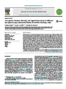
Pak. J. Bot., 43: 129-133, Special Issue, December, 2011 (Medicinal Plants: Conservation & Sustainable use)
SPECIES RICHNESS, ETHNOBOTANICAL SPECIES RICHNESS AND HUMAN SETTLEMENTS ALONG A HIMALAYAN ALTITUDINAL GRADIENT: PRIORITIZING PLANT CONSERVATION IN PALAS VALLEY, PAKISTAN ZAFEER SAQIB1, 2*, RIFFAT NASEEM MALIK2, MUHAMMAD IBRAR SHINWARI1, ZABTA KHAN SHINWARI3 1
Department of Environmental Science, International Islamic University, Islamabad Environmental Biology Laboratory, Department of Plant Sciences, Quaid-i-Azam University, Islamabad 3 Department of Biotechnology and Bio-informatics, Faculty of Biological Sciences, Quaid-i-Azam University, Islamabad * Corresponding author email:
[email protected] 2
Abstract This study explores the distribution pattern of species richness and ethnobotanically important plant species richness along an altitudinal gradient in Palas valley, Pakistan. The data related to species’ occurrences were derived from field GPS surveys from 2004 to 2007, while settlement data were obtained from Google Earth™. The altitudinal information, based on locational data of species and settlements, was extracted from a 30 m resolution digital elevation model (DEM) using a geographic information system (GIS). Species richness and number of houses were then determined for 100 m altitudinal intervals and tested as response variables against altitude (independent variable) to explore their possible relationships using scatter plots and quadratic regression. The species richness was found to follow a bell-shaped distribution (R2=0.87) with a maximum near midaltitudes. The greatest species richness was attained between 2400-3200 m a.s.l (above sea level) and ethnobotanically important species richness was highest between 2500-2800 m a.s.l. (R2=0.93). There was a highly positive correlation (r=0.88) between species richness and ethnobotanically important species richness. The majority of settlements were distributed between 20002400 m a.s.l. (R2=0.47). The highest overall plant species richness, as well as ethnobotanically important species, is thus attributed to altitudes adjacent to but higher than the permanent settlements (2400-3200 m a.s.l.). Considering the valley as an important species rich area within its neighborhood, the localities in mid-altitudes (2400-3200 m a.s.l.) should be considered as major sites to be managed for the sustainable harvest of local plant resources and for plant conservation in a regional context.
Introduction The northern part of Pakistan is characterized by mountainous terrain with distinct altitudinal zonations of climate, vegetation types and land use systems. Since the population is largely rural, there is extra heavy reliance on wild plants and their products to meet daily food, shelter, medicinal and other requirements, and there is an everincreasing demand for these species because they are freely available (Sundriyal & Sundriyal, 2004). The commercialization of certain plants and their exploitation to meet pecuniary needs have also threatened their survival in some parts, especially when the source is a nearby forest. Therefore it is important to know the patterns of richness and distribution of plants, particularly in relation to human settlement patterns for management and conservation. Hotspots of biological richness have been always looked upon as conservation priorities (Mittermeier et al., 2005), and considerable attention has been paid to the factors determining species richness (Malik & Husain, 2006). Altitude is one of the important determinants of species richness, particularly in mountainous terrain, as it influences temperature and precipitation, thus directly affecting the distribution and abundance of plants (Austin, 2007). In general, plant species richness decreases with increasing elevation, but peaks at mid-altitudes (Wohlgemuth et al., 2008). The relationship between altitude and species diversity has been investigated in many studies both worldwide and within the Himalayas (Vetaas & Grytnes, 2002), however, richness of ethnobotanically important species in relation to altitude has been rarely studied (Acharya et al., 2009). The hilly tracts of Hazara division, Pakistan, are part of the Himalayan mountain chain and have been identified as containing the richest flora in the country, with more than 1700 species of vascular plants (Stewart, 1957). The Palas
Valley has more than 600 vascular plant species, with the majority having a distribution confined to the Northern Mountains of Pakistan, Kashmir and East Afghanistan. Only about one third of the flora has a wider distribution and importantly, the vegetation is still in relatively pristine condition (Rafiq, 1996). Just like other neighboring valleys, livestock keeping and herd raising are the backbone of the local economy in Palas. The people seasonally occupy high (sub-) alpine pastures (>3000 m a.s.l.) to graze their livestock during summers and return to their permanent residences (1800-2400 m a.s.l.) during winters. Since agriculture is not very prominent, the locals have to rely on wild vegetation to supplement their dietary, fiscal, medicinal, housing and other requirements (Saqib & Sultan, 2005). Though many articles have been written on the human-vegetation connection, both in Pakistan and worldwide, their main focus has been only the systematic documentation of useful plants (Ali & Qaiser, 2009; Khan et al., 2003; Qureshi & Bhatti, 2008). There is a serious deficiency of quantitative information on the distribution pattern of ethnobotanically important plants, especially with reference to human settlement patterns. Since the scant information on distribution patterns of the target species may lead to their ineffective management and conservation practices (Saqib et al., 2006), the present study specifically focuses on the distribution patterns of useful plants along the altitudinal gradient in Palas Valley and its correlation to human settlement patterns. Materials and Methods The study area: The Palas Valley covers an area of about 1400 hectares (Fig. 1) and is located on the eastern bank
ZAFEER SAQIB ET AL.,
130
of the river Indus in District Kohistan (Khyber Pakhtoonkhwa), c. 170 km north of Islamabad, and extends between 34.73°N to 35.21°N latitude and 72.90°E to 73.58°E longitude (Google Earth™). Altitude varies from 500 m a.s.l. at Chakot (near the river Indus) to 5200 m a.s.l. at Mukchaki Peak at the northern boundary. The valley is bounded by Jalkot (Kohistan district) to the north, Naran (Mansehra district) to the east, Alai (Battagram district) to the south and Pattan (Kohistan
district) to the west. The valley consists of a southwestern watershed Kuz-Palas, drained by Sharakot and Sharial Nalah (rivulets) and a larger northern watershed Bar Palas/Daro Palas that is drained by the Musha’Ga Nalah. The climate is influenced by both western disturbances and the edge of the monsoon, thus supporting luxurious forest growth. The mean annual precipitation in Palas ranges from 900 mm near Indus to 1350 mm at higher elevations (Sinnott et al., 1995).
Fig. 1. Map of the study area showing its location, drainage patterns and main watersheds.
The social system is based upon egalitarian formations that lack status or rank distinctions and are free from outside coercive controls and feudal exploitation. The locals practice marginal/subsistence agriculture (mixed maize-vegetables cropping), but livestock rearing is the main source of income. The population of Palas, according to a 1998 population census, was more than 60,500 individuals and c. 70% of the population belonged to Kuz Palas (Anon., 1998). Data collection: Data on altitudinal distributions of plant species were derived from ecological observations taken during transect walks and field surveys carried out from 2004-2007, during the whole length of the growing period. Data points for each plant species were collected with a handheld global positioning system (GPS) device (Garmin GPSMAP® 60). The locational data for all recognizable houses were derived from Google Earth™. The altitude for each species occurrence and house/settlement was extracted from a 30 m resolution digital elevation model (DEM) of the study area based on ASTER satellite data (www.gdem.aster.ersdac.or.jp). A species was considered to be “present” in the whole altitudinal range bounded by its observed upper and
lower elevation limits. Species richness was determined as the number of species present within 100 m elevation intervals/bins (total of 46 intervals from 500-5100 m a.s.l.). Ethnobotanical information was obtained from the locals during transect walks as well as during semistructured interviews; see Saqib & Sultan, (2005) for methodology. Pearson correlations were determined between elevation, species richness, ethnobotanically important species richness and proportion of human settlements to explore their interrelationships. The trend in species richness and ethnobotanically important species richness along an altitudinal gradient was modeled using quadratic regression in R for Windows ver. 2.13.1 (Anon., 2011). Results and Discussion The altitudinal distribution data were synthesized for a total of 545 species, out of which 170 plants were found to be customarily used by locals. The highest proportion of plants was used for medicinal purposes (89 species), followed by food (32 regular diet species, total plants = 59) and fodder plants (22 species). There were 18 plants
131
with commercial value (mainly medicinal), and 10 species were used as preferred fuel wood. A total of 12 species were categorized in a miscellaneous use class, including those used for making agricultural implements, pottery tools and cleaning utensils, etc. (Saqib & Sultan, 2005) A negative correlation was observed between altitude and all other variables. The highest negative correlations with elevation were observed for fodder species richness (r=-0.61) and regular diet food plants (r=-0.56), suggesting that fodder and chief food plants are mainly collected at altitudes near permanent settlements, i.e., 2000-2500 m a.s.l. (Fig. 2). With the exception of medicinal and commercially important plants, all other
categories of ethnobotanically important species had relatively stronger positive correlations with the number of houses (r>0.42). Out of 18 species commonly brought to the market, 10 are medicinal plants (Angelica glauca, Geranium wallichianum, Paeonia emodi, Pistacia chinensis, Podophyllum hexandrum, Rheum webbianum, Saussurea costus, Thymus linearis, Valeriana jatamansii and Viola betonicifolia) and mainly collected from the montane zone (2500-3100 m a.s.l.) under Picea smithiana and Abies pindrow forest; a few species are collected from (sub-)alpine areas. These are mid elevations where both species richness and ethnobotanically important species richness (especially medicinal plants) are highest.
Fig. 2. The scatter plot of altitude against settlements and species richness showing an obvious increase in species richness at midaltitudes. Settlements peak at elevations just below the mid-altitudes. The altitudinal zonation as shown in shaded background is modified after Dickoré & Nüsser (2000).
In summary, the high correlation between species richness and ethnobotically important species richness simply implies that the higher the species diversity, the greater the utilization potential or perceived usefulness.
1. 2. 3. 4. 5. 6. 7. 8. 9. 10.
Most important is that the species rich sites are well within reach of the locals (Table 1). The correlation between the usefulness of a plant and access/availability has been repeatedly demonstrated (Thomas et al., 2009).
Table 1. The correlation matrix for the elevation, house density and species richness. 1 2 3 4 5 6 7 8 Elevation 1 Houses (number) -0.36 1 Species richness (total) -0.04 0.18 1 Ethnobotanical species richness -0.37 0.45 0.88 1 Medicinal plant richness -0.37 0.36 0.91 0.98 1 Commercial plant richness -0.28 0.19 0.93 0.90 0.95 1 Food plant richness (all) -0.35 0.47 0.86 0.99 0.96 0.86 1 Food plant richness (regular) -0.56 0.50 0.75 0.95 0.93 0.83 0.96 1 Food plant richness (occasional) -0.18 0.42 0.90 0.97 0.94 0.84 0.98 0.88 Fodder plant richness -0.61 0.68 0.34 0.73 0.66 0.46 0.75 0.84
9
10
1 0.65
1
ZAFEER SAQIB ET AL.,
132
The scatter plot of species richness against altitudinal gradient revealed that the species do not follow a monotonic decrease, as could be inferred from the correlation analysis (Table 1 & Fig. 2), but rather a bellshaped species richness pattern is seen that peaks around mid elevations in montane vegetation zone (Fig. 2). The determination coefficient of the regression model (Table 2, Equation 1) for number of houses vs altitude was 0.47, whereas its value for (ethnobotanically important) species
richness against elevation was greater than 0.68 (Table 2, Equation 3), indicating a strong relationship with altitude. In the Himalayan region, such unimodal patterns of species richness with respect to altitude are common (Acharya, et al., 2009; Bhattarai & Vetaas, 2003; Hamilton & Radford, 2007). Similar richness patterns have been observed from other mountainous regions of the world as well (Levin et al., 2007; Wang et al., 2003; ZhenHua et al., 2007).
Table 2. The regression equations quantifying the relationship of species richness and number of houses with elevation. Equation No. Term Relationship with elevation R2 1 Houses (number) = -0.11 × elevation2 + 4.37 × elevation + 59.24 0.47 2 Species richness = -0.34 ×elevation2 + 20.53 × elevation - 44.07 0.87 0.93 3 Ethnobotanically important species richness = -0.11 × elevation2 + 5.69 × elevation + 10.28 2 0.91 4 Medicinal species richness = -0.05 × elevation + 3.0 × elevation + 7.20 5 Commercial species richness = -0.01 × elevation2 + 0.53 × elevation + 0.72 0.73 0.90 6 Food species richness = -0.0422 × elevation2 + 2.2633 × elevation + 3.3164 0.68 7 Fodder species richness = -0.0114 × elevation2 + 0.4093 × elevation + 9.01
Since most of the settlements are located in the submontane and lower montane zones, these areas may be most affected by human activities. Human activities in montane zones can lead to a reduction in natural habitat, and reduced species richness at these altitudes has also been reported by Nogues-Bravo et al., (2008). The correlation between altitude and climate can well explain the high species richness at mid-altitudes, because the maximum species richness is expected at locations with higher precipitation, which generally occurs at higher altitudes. Other authors have observed that moist conditions at upper montane vegetation zones are correlated with higher species richness (Schweinfurth, 1984; Vetaas & Grytnes, 2002; von Wehrden et al., 2010). The mid-altitude species richness peak may also be attributed to the large-scale mass effect due to flow of individuals or source-sink dynamics (Shmida & Wilson, 1985), due to which these elevations get inputs from both upslope and low-lying areas. Elevations ranging from 2500-3000 m a.s.l. showed maximum species richness and ethnobotanically important species richness; permanent settlements are located below this altitude, which might have resulted in a montane zone relatively protected from anthropogenic disturbance. However, this zone can be regarded as a zone of economic activity since the majority of the commercial plants are obtained from these elevations. Therefore, these elevations should be considered priorities for conservation, especially in regional context; they should also be considered for sustainable harvest of plant resources. In a regional context, comparable elevations in other valleys have already been exhausted. The only protected area in the region is Saiful Malook and Lulusar-Dodipat National Park, Naran, (east of the study area), which only covers the alpine region (>3200 m a.s.l.) and thus misses the altitudes with the greatest diversity and utility. Conclusion Plant species richness in the Palas Valley follows a bell-shaped curve along an altitudinal gradient that has been observed from other parts of the Himalayas as well. Ethnobotanically important species richness follows the same pattern and seems to be directly related to overall species richness. Since the mid-altitudes (2500-3000 m
a.s.l.) are important areas with respect to overall and ethnobotanically important species richness, they should be the priority for plant conservation efforts. References Acharya, K., R. Chaudhary and O. Vetaas. 2009. Medicinal plants of Nepal: Distribution pattern along an elevational gradient and effectiveness of existing protected areas for their conservation. Banko Janakari, 19(1): 16-22. Ali, H. and M. Qaiser. 2009. The ethnobotany of Chitral valley, Pakistan with particular reference to medicinal plants. Pak. J. Bot, 41(4): 2009-2041. Anonymous. 2011. R: A language and environment for statistical computing. R Foundation for Statistical Computing, Vienna, Austria. Austin, M. 2007. Species distribution models and ecological theory: A critical assessment and some possible new approaches. Ecol. Model., 200(1-2): 1-19. Bhattarai, K.R. and O.R. Vetaas. 2003. Variation in plant species richness of different life forms along a subtropical elevation gradient in the Himalayas, East Nepal. Global Ecol. Biogeogr., 12(4): 327-340. Dickoré, W. B. and M. Nüsser. 2000. Flora of Nanga Parbat (NW Himalaya, Pakistan): An annotated inventory of vascular plants with remarks on vegetation dynamics. Englera, (19): 3-253. Anonymous. 1998. District census report of Kohistan. Population Census Organization, Statistics Division. Hamilton, A. and E. Radford. 2007. Identification and conservation of important plant areas for medicinal plants in the Himalaya. Plantlife International, Salisbury, United Kingdom, and Ethnobotaniocal Society of Nepal, Kathmandu, Nepal. Khan, A., S.S. Gilani, F. Hussain and M.J. Durrani. 2003. Ethnobotany of Gokand Valley, District Buner, Pakistan. Pak. J. Biol. Sci., 6: 363-369. Levin, N., A. Shmida, O. Levanoni, H. Tamari and S. Kark. 2007. Predicting mountain plant richness and rarity from space using satellite-derived vegetation indices. Diversity and Distributions, 13(6): 692-703. Malik, R.N. and S.Z. Husain. 2006. Classification and ordination of vegetation communities of the Lohibehr reserve forest and its surrounding areas, Rawalpindi, Pakistan. Pak. J. Bot., 38(3): 543. Mittermeier, R.A., P.R. Gil, M. Hoffman, J. Pilgrim, T. Brooks, C.G. Mittermeier, J. Lamoreux, G.A.B. Da Fonseca and P.A. Saligmann. 2005. Hotspots revisited: earth's
133
biologically richest and most endangered terrestrial ecoregions: Cemex, Mexico City. Nogues-Bravo, D., M.B. Araujo, T. Romdal and C. Rahbek. 2008. Scale effects and human impact on the elevational species richness gradients. Nature, 453(7192): 216-219. Qureshi, R. and G.R. Bhatti. 2008. Ethnobotany of plants used by the Thari people of Nara Desert, Pakistan. Fitoterapia, 79(6): 468-473. Rafiq, R.A. 1996. Taxonomical, chlorological and phytosociological studies on the vegetation of Palas valley: Pakistan Agriculture Research Centre, Islamabad, Pakistan. Saqib, Z. and A. Sultan. 2005. Ethnobotany of Palas Valley, Pakistan. Ethnobotanical Leaflets, 2005(1): 28. Saqib, Z., R.N. Malik and Z. Hussain. 2006. Modelling potential distribution of Taxus wallichiana in Palas Valley, Pakistan. Pak. J. Bot., 38(3): 539-542. Schweinfurth, U. 1984. The Himalaya: complexity of a mountain system manifested by its vegetation. Mt. Res. Dev., 4(4): 339-344. Shmida, A. and M.V. Wilson. 1985. Biological determinants of species diversity. J. Biogeogr., 12: 1-20. Sinnott, M., R. Rafiq, A. Jackson and J. Burnell. 1995. Royal Botanic Gardens Kew: Pakistan expedition 1995. Stewart, R.R. 1957. Flora of Rawalpindi District, West Pakistan I. Pak. J. Forest., 7(1): 237-300. Sundriyal, M. and R. Sundriyal. 2004. Wild edible plants of the Sikkim Himalaya: Marketing, value addition and implications for management. Econ. Bot., 58(2): 300-315.
Thomas, E., I. Vandebroek, P. Van Damme, P. Goetghebeur, D. Douterlungne, S. Sanca and S. Arrazola. 2009. The relation between accessibility, diversity and indigenous valuation of vegetation in the Bolivian Andes. J. Arid Environ., 73(9): 854-861. Vetaas, O.R. and J.A. Grytnes. 2002. Distribution of vascular plant species richness and endemic richness along the Himalayan elevation gradient in Nepal. Global Ecol. Biogeogr., 11(4): 291-301. von Wehrden, H., J. Hanspach, K. Ronnenberg and K. Wesche. 2010. Inter-annual rainfall variability in Central Asia - A contribution to the discussion on the importance of environmental stochasticity in drylands. J. Arid Environ., 74(10): 1212-1215. Wang, G., G. Zhou, L. Yang and Z. Li. 2003. Distribution, species diversity and life-form spectra of plant communities along an altitudinal gradient in the northern slopes of Qilianshan Mountains, Gansu, China. Plant Ecol., 165(2): 169-181. Wohlgemuth, T., M. P.Nobis, F. Kienast and M. Plattner. 2008. Modelling vascular plant diversity at the landscape scale using systematic samples. J. Biogeogr., 35(7): 1226-1240. ZhenHua, S., P. ShengJing and O. XiaoKun. 2007. Rapid assessment and explanation of tree species abundance along the elevation gradient in Gaoligong Mountains, Yunnan, China. Chinese Science Bulletin, 52: 225-231.
(Received for publication 16 October 2011)