The Chilean Ultraviolet Radiation Network: monitoring and forecasting the. UV index for health protection. Solangela Sánchez Cuevas, Jorge F. Carrasco and ...
2339b H e a lt h
The Chilean Ultraviolet Radiation Network: monitoring and forecasting the UV index for health protection Solangela Sánchez Cuevas, Jorge F. Carrasco and Humberto Fuenzalida, Dirección Meteorológica de Chile – Dirección General de Aeronáutica Civil
T
he Dirección Meteorológica de Chile (DMC) operates an ultraviolet radiation network (URN) consisting of 20 stations, most of them deployed in a meridional transect from around 17º S to 56º S, including one station at Easter Island and another on the northern tip of the Antarctic Peninsula (~62º S). The stations measure solar ultraviolet radiation within the wavelength range 280-320 nm (UV-B). The data are expressed in terms of erythemic irradiance as a risk index (UVI), according with the World Meteorological Organization (WMO) and the World Health Organization (WHO). Daily 24-hour maxima of UVI are predicted for cities where the stations are located.
Image: Sociedad Dermatológica de Chile
The continental Chilean territory spreads in a north-south direction for about 4,500 km along the western coast of South America (17° S to 56° S) including the Andes Range with several peaks exceeding 6,000 m. It hosts a large variety of climates, from north to south and from the coast to the mountains. Apart of the annual cycle, the near-surface air temperature decreases southward and eastward due to altitude, while precipitation varies from north to south with a maximum in extratropical latitudes where weather systems travel eastward. In the northern part is the driest desert of the world, while in the southern part (50° S) the rainy region (more than 6,000 mm per year) is found, along with the largest continental ice caps in the world outside the Polar regions (the Northern and Southern Patagonian Ice
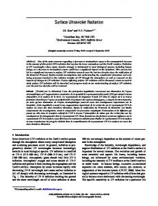
Sunburn caused by excessive exposure to UV radiation
[ 121 ]
Fields). In spring, the southern Chilean territory is also exposed to a thinner stratospheric ozone layer that fluctuates between 260 and 300 Dobson Units (DU), well below what is considered a normal value (350 DU). This means that incoming ultraviolet radiation (UV) reaching the ground is a hazard, mainly during solar noon hours with values that can exceed the limit considered a risk for human health. During cloudless sky conditions, the total amount of UV-B received on the surface varies with latitude, terrain altitude and the time of year; therefore, UV-B is higher towards the Equator than towards the poles, increases with altitude, and presents a maximum near the summer solstice. The Chilean URN measures UV-B irradiance, which is used to calculate the erythemic irradiance and finally expressed in term of the UVI risk index to transmit a simple warning message to the public. The UVI is a measure of the UV-B intensity on the earth surface at the solar noon, is given on a scale that runs from zero to more than 11, according with WMO and WHO. The index represents the risk level for skin damage due to sun exposure. At present, 20 stations are deployed at different cities from Arica in northern Chile (~ 18°, 70°W, 23 metres above sea level (masl)) to Eduardo Frei Montalva (~ 62°S, 53°W, 10 masl) located on the northern tip of the Antarctic Peninsula. The distribution of the URN includes stations in coastal and inland cities, as well as, three stations located at higher elevations such as San Pedro de Atacama (~ 18°S, 70°W, 2450 masl), El Tololo (~ 30°S, 70°W, 2030 masl) and Central Andes (~ 33°S, 71°W, 2746 masl). There is also a station at Easter Island (~ 27°S, 109°W, 47 masl). All the stations are equipped with a pyranometer instrument with a sensor that measures UV-B radiation within the spectral band 280-320 nm. The unit used is the miliwatt/metre2 (mW/m2). The DMC also has a standard pyranometer which is calibrated in the World Radiation Centre of the Physikalish-Meteorologisches Observatorium DavosInstitute, Switzerland. This instrument is used as a reference for calibration, which is done by comparing the data recorded by the standard pyranometer simultaneously with those under.
H e a lt h
The worldwide increase in skin cancer, people exposing themselves to direct solar radiation, the global depletion of the stratospheric ozone, and the fact the Chilean territory can directly be affected by the ozone hole were all motivations for DMC to implement the URN for measuring UV-B. The objective of this initiative was to create through time a database that would permit the study of the impact of ozone depletion in Chile. Thus, the data analysis would be used to improve our knowledge of spatial and temporal distribution. At the same time, all this new information would help to develop prevention programmes to overcome the adverse effects of the eventual UV-B increase. The first station was installed in the capital city of Santiago (~ 33°S, 70°W, 520 masl) in 1992, where almost half the nation’s population is located. A second station was deployed in the Antarctic Chilean Base Eduardo Frei Montalva, a
place affected by the spring ozone depletion associated with the ozone hole. Annual and daily cycles of UVI were characterized at different locations in Chile, using data collected for the corresponding stations. Five years of almost continuous monitoring in most of the stations has allowed the analysis of UV-B behaviour and how it is influenced by factors such as elevation, latitude, surface reflectivity and cloud cover and type. The monthly average UVI behaviour in Chilean territory shows an annual cycle with a maximum in January and a minimum in June, as well as the southward decrease with higher values in the northern part, reflecting the astronomical and latitudinal factors. The daily seasonal average cycle reveals that the maximum
UVI descriptions and associated recommendations UVI
Description
Media Graphic Colour
0-2 Low
No danger to the average person
Green
Wear sunglasses on bright days; use sunscreen if there is snow on the ground, which reflects UV radiation, or if you have particularly fair skin.
3-5 Moderate
Little risk of harm from unprotected sun exposure
Yellow
Wear sunglasses on bright days; use sunscreen if there is snow on the Wear sunglasses and use sunscreen, cover the body with clothing and a hat, and seek shade around midday when the sun is most intense., which reflects UV radiation, or if you have particularly fair skin.
6-7 High
High risk of harm from unprotected sun exposure
Orange
Wear sunglasses and use sunscreen having SPF 15 or higher, cover the body with sun protective clothing and a wide-brim hat, and reduce time in the sun from two hours before to three hours after solar noon (roughly 11:00 to 16:00 LT during summer).
8-10 Very high
Very high risk of harm from unprotected sun exposure
Red
11+ Extreme
Extreme risk of harm from unprotected sun exposure
Violet
Recommended Protection
Wear sunscreen, a shirt, sunglasses, and a hat. Do not stay out in the sun for too long.
Take all precautions, including: wear sunglasses and use sunscreen, cover the body with a long-sleeve shirt and trousers, wear a very broad hat, and avoid the sun from two hours before to three hours after solar noon.
Source: DMC
[ 122 ]
H e a lt h
Image: Sociedad Dermatológica de Chile
is recorded around 13:00 local time (LT) year-round in the whole country. In northern and central Chile, the period of high-risk exposure (levels above 6) goes from 10:00 to 17:00 LT in summer, while in the most southern city (Punta Arenas, ~ 53°, 70°W, 39 masl), on average, the UVI is under level 6 risk year-round; that is, the index only reaches moderate values which are equivalent to small risk of damage from unprotected sun exposure. However, during spring, Punta Arenas and the surrounding areas can experience episodes of significant UVI increase. Analysis of the data recorded by stations deployed at different elevations indicates an increment of UV – and therefore of the UVI – with altitude. This is due to two factors: first, at higher altitudes more UV can get to the surface because the atmosphere is thinner. And second, due to a clearer atmosphere, lower values of aerosol optical depth are found near the surface atmosphere as compared with values at lower altitudes.1 In northern Chile, comparison between data recorded by the stations located at Antofagasta (~ 23°S, 70°W, 115 masl) and San Pedro de Atacama during cloudless days in summer reveals differences in UVI of five to seven levels, which correspond to an altitudinal increase of two to three units per kilometre. However, on average, results from the Chilean stations concur with the overall altitudinal increment of 10-12 per cent of the UV levels per kilometre. This altitudinal factor on UV radiation is not constant throughout the year; significant seasonal variation is mainly found in winter when the vertical differences at midday hours are higher due to a greater solar zenith angle. The incoming UV irradiance is attenuated by clouds, which depend on both thickness and cloudiness (type and amount). Thin
Skin cancer caused by excessive exposure to UV radiaton
[ 123 ]
or scattered cloud can have little effect or even enhance the UV compared with cloudless skies. On the other hand, cloudy days can decrease UV irradiance reaching the ground by absorption and scattering through the water vapour and the aerosols. A good correlation between UV and cloudiness was found at stations located in northern and central Chile (r = 0.88 for Santiago), but the correlation is poor in the southern regions, most probably due to the presence of cumuliform clouds as revealed the study done at Valdivia.2 However, days with a concentration below 250 DU can correlate with episodes of increased UVI under cloudless sky conditions in summer. The impact of this on human health is documented by a medical study3 that found a relation between stratospheric ozone concentration below 260 DU and cases of sunburn in children due to exposure during January. With regard to the ozone hole that develops in the southern Polar regions during the spring season, regions with minimum concentration eventually reach the Antarctic Peninsula and the southern tip of South America. Large increases in UV-B associated with the Antarctic ozone hole have been measured, with increases up to 38 times those of similar days with normal ozone.4 Significant decreases of stratospheric ozone along with increments of UV-B occurred during the mid and late austral spring of 1999. These events caused a significant increase of patients with sunburn in Punta Arenas.5 The stratospheric ozone layer is a natural protective filter for the harmful UV radiation provided by the atmosphere. Depletion of this layer has negative effects on flora and fauna, including human health, due to exposure to higher UV levels. This fact motivated some senators and the Chilean Government to produce a law regarding the protection of the stratospheric ozone layer. The Ozone Law, as it is called, was published in 2006. Its main objectives are to establish control mechanisms for substances that deplete the stratospheric ozone, and to ensure the appropriate implementation of the Montreal Protocol and the protection of human health and ecosystems affected by UV. The law gives responsibility to the DMC as the official source of information and public dissemination of the UVI and risk for human beings. Today, the daily maximum UVI and the prediction for the next day can be found on the institutional webpage www.meteochile.gob.cl. The law was later complemented by a Supreme Decree that was published in 2011, with the purpose of establishing regulations for health protection and preventions to be applied at workplaces. This is a pioneer legislation in Latin America which establishes a precedent in the prevention of occupational health risk in the country. In this context permanent monitoring, the addition of new stations to the URN, climate UV studies and the daily forecast have become essential information not only with regard to physical and biological effects over the territory, but also with regard to supporting decision-makers within the framework of protecting public and occupational health.