Continental Shelf Research 138 (2017) 120–131
Contents lists available at ScienceDirect
Continental Shelf Research journal homepage: www.elsevier.com/locate/csr
Thermohaline forcing and interannual variability of northwestern inflows into the northern North Sea
MARK
⁎
Peter M.F. Sheehana, , Barbara Berxb, Alejandro Gallegob, Rob A. Halla, Karen J. Heywooda, Sarah L. Hughesb a Centre for Ocean and Atmospheric Sciences, School of Environmental Sciences, University of East Anglia, Norwich Research Park, Norwich NR4 7TJ, United Kingdom b Marine Scotland Science, 375 Victoria Road, Aberdeen AB11 9DB, United Kingdom
A R T I C L E I N F O
A BS T RAC T
Keywords: North Sea Fair Isle Current East Shetland Atlantic Inflow Thermohaline circulation Seasonal variability Interannual variability
A long-established, 127 km-long hydrographic section in the northern North Sea at 59.28°N that runs from the eastern coast of Orkney (2.23°W) to the central North Sea (0°) crosses the path of the main inflows of Atlantic water. Data from 122 occupations between 1989 and 2015 are examined to determine the annual cycle and long-term trends of temperature, salinity and depth-varying geostrophic flow across the section. In an average year, the geostrophic flow referenced to the seafloor is at its narrowest (40 km) in winter, during which time it is driven by the strong horizontal salinity gradient; the horizontal temperature gradient is very weak. Velocity exceeds 4 cm s−1, but transport is at a minimum (0.11 Sv). In the deeper water in the east of the section, thermal stratification develops throughout summer and persists until October, whereas the west is tidally mixed all year. The bottom temperature gradient becomes the primary driver of the geostrophic flow, which is fastest (9 cm s−1) in September and broadest (100 km) in October. Maximum transport (0.36 Sv) occurs in October. Throughout the summer, the horizontal salinity gradient weakens, as does its contribution to the flow. However, it nevertheless acts to broaden the flow west of the location of the strongest horizontal temperature gradient. Section-mean de-seasoned temperature is found to be positively correlated to the Atlantic Multidecadal Oscillation and negatively correlated to the North Atlantic Oscillation. These results refine our understanding of the thermohaline forcing of Atlantic inflow into the northern North Sea, particularly in relation to the salinity distribution. Understanding the variability of this inflow is important for understanding the dynamics of the North Sea ecosystem.
1. Introduction The North Sea is a shallow shelf sea on the northwestern European continental shelf that lies between the United Kingdom and continental Europe (Fig. 1). Inflow to the North Sea from the North Atlantic occurs through the English Channel (English Channel Inflow), between the Orkney and Shetland Islands (Fair Isle Current, FIC), along the eastern coast of the Shetland Islands (East Shetland Atlantic Inflow, ESAI), and along the western slope of the Norwegian Trench (Norwegian Trench Inflow) (Otto et al., 1990; Svendsen et al., 1991; Turrell et al., 1996). Outflow occurs primarily in the Norwegian Coastal Current (NCC) (Damm et al., 1994). The approximate locations of these flows are illustrated in Fig. 1. These currents are, in turn, largely fed by the ShelfEdge Current, which flows northwards along the European continental margin (Turrell et al., 1996; Marsh et al., 2017). Input to the FIC also occurs from the Scottish Coastal Current, a northward flow along the ⁎
western coast of Scotland. The Channel Inflow is weak compared with the northern inflows (Otto et al., 1990; Winther and Johannessen, 2006). The Norwegian Trench Inflow is the largest by volume transport (Otto et al., 1990; Winther and Johannessen, 2006) but it retroflects within the Norwegian Trench and flows out with the NCC. Consequently, it is the FIC and ESAI, the northwestern inflows, that have the greatest effect on conditions in the northern North Sea. The waters of the northwestern inflows approximately follow the 100 m isobath southwards down the eastern coast of Scotland before turning eastwards between 57.5 and 58°N and flowing towards Norway. Within the North Sea, the circulation is broadly cyclonic (Otto et al., 1990; Hill et al., 2008). The rate of oceanic inflow strongly influences the region's ecosystem (Lindley et al., 1990; Holliday and Reid, 2001; Edwards et al., 2002; Beaugrand, 2004), and the FIC and ESAI provide pathways for perturbations of oceanic origin to propagate into the North Sea
Corresponding author. E-mail address:
[email protected] (P.M.F. Sheehan).
http://dx.doi.org/10.1016/j.csr.2017.01.016 Received 3 November 2016; Received in revised form 20 January 2017; Accepted 23 January 2017 Available online 25 January 2017 0278-4343/ Crown Copyright © 2017 Published by Elsevier Ltd. This is an open access article under the OGL license (http://creativecommons.org/licenses/OGL/3.0/).
Continental Shelf Research 138 (2017) 120–131
P.M.F. Sheehan et al.
summer and primarily wind-driven in winter (Dooley, 1983; Otto et al., 1990; Svendsen et al., 1991; Turrell, 1992; Pohlmann and Puls, 1994; Winther and Johannessen, 2006). During the spring, stratification develops offshore of both the Orkney and Shetland archipelagoes as atmospheric heating warms the surface, isolating cool, dense waters left over from the previous winter beneath the thermocline (Svendsen et al., 1991; Turrell, 1992; Turrell et al., 1996; Hill et al., 2008). Closer to the shore, tidal currents are sufficiently strong that the water column remains fully mixed even when deeper, offshore waters are stratified (Svendsen et al., 1991). The density front that emerges between these two regions drives an along-front jet between the dense bottom water in the offshore, stratified region and the lighter water in the coastal mixed region (Svendsen et al., 1991; Turrell, 1992; Hill et al., 2008). This density pattern is common on the northwestern European shelf and makes the FIC and ESAI part of the thermohaline circulation that is a common feature on the northwestern European continental shelf in summer (Brown et al., 1999; Hill et al., 2008). The zonal salinity distribution reinforces this density pattern. The waters of the FIC originate along the western coast of Scotland where, prior to entering the North Sea, they are mixed with fresh water of terrestrial origin (Turrell et al., 1990; Turrell, 1992). The salinity gradient between water that exhibits this fresh water influence and more saline water found offshore may be traced around the northern coast of Scotland (Dooley, 1974). The lack of major river systems on, and the relatively small landmass of, the Orkney and Shetland Islands, means that further appreciable addition of fresh water to the FIC and ESAI from terrestrial sources does not occur in the vicinity of these archipelagoes. The switch to a wind-driven regime occurs because wind forcing is stronger in winter (Coelingh et al., 1996; Siegismund and Schrum, 2001). Winds from the west and north tend to force an anti-clockwise circulation around the northern North Sea, a pattern that promotes inflow of water from the northwest (Furnes, 1980). The correlation between volume transport in the inflows and the North Atlantic Oscillation (NAO; Hurrell et al., 2003), an index which characterises the meridional pressure difference across the North Atlantic and the strength of westerly winds in the region, is higher at this time of year than it is in summer (Winther and Johannessen, 2006; Hjøllo et al., 2009). The breakdown of thermal stratification is also important (Turrell et al., 1990): the disappearance of the thermocline enhances Ekman transport throughout the water column (Winther and Johannessen, 2006) and reduces the density difference between nearand offshore regions, lessening the influence of the horizontal density gradient on the circulation (Turrell, 1992). A horizontal salinity gradient persists between the low-salinity coastal water and the highsalinity water of Atlantic origin towards the centre of the North Sea (Turrell, 1992), but Prandle (1984) estimates that it drives a flow an order of magnitude less than that driven by the wind. Our understanding of the annual cycle of non-wind-driven flow in the Atlantic inflow has, to date, been based on observations from limited periods of time. Previous studies have relied on current meter records from a few months and on hydrographic observations from single cruises (e.g. Furnes, 1980; Turrell et al., 1990; Brown et al., 1999). Descriptions of the hydrography and flow in the region based on long-term observations are lacking in the literature. Volume fluxes are known to be limited by narrow sampling windows when estimated from observations (Hjøllo et al., 2009), and the role of non-wind-driven forcing in winter is not well understood (Dooley, 1983). Furthermore, the effect of horizontal temperature and salinity gradients on the nonwind-driven flow is yet to be considered separately. That stratification and horizontal temperature gradients influence the current has been understood for some time (Backhaus and Maier-Reimer, 1983; Turrell, 1992), as has the role of thermohaline circulation in the shelf seas more generally (Hill et al., 2008). The influence of horizontal salinity gradients on the Atlantic inflow has received less attention, and no attempt has been made to describe and quantify the separate influence of temperature and salinity gradients.
Fig. 1. Bathymetric map of the North Sea. The location of the JONSIS line and the approximate paths of the Fair Isle Current (FIC), East Shetland Atlantic Inflow (ESAI), Norwegian Trench Inflow (NTI), Norwegian Coastal Current (NCC) and English Channel Inflow (ECI) are shown (Otto et al., 1990; Turrell, 1992). Shading indicates depth from 0 to 1250 m; the 100 m isobath is marked in grey. Bathymetric data are from the GEBCO_08 grid, version 20100927 (www.gebco.net).
(Dickson et al., 1988; Holliday and Reid, 2001; Edwards et al., 2002). Reliable models of contaminant pathways and of water quality depend on accurate knowledge of these inflows (Taylor, 1987; Turrell and Henderson, 1990); reliable models of phytoplankton and nutrient distributions depend on proper physical modelling (Skogen and Moll, 2005). In the last decade, the EU's Marine Strategy Framework Directive has placed on EU member states the responsibility of ensuring “good environmental status” (EU, 2008) for their territorial waters, so providing a regional regulatory driver to efforts to improve our understanding of the physical and ecological dynamics of the North Sea. The FIC has been described in broad terms as a southward-flowing current, approximately 30 nautical miles (56 km) wide (Svendsen et al., 1991), that flows through the Fair Isle Gap between the Orkney and Shetland islands (Dooley, 1974). In the North Sea, it is found close to the eastern coast of the Orkneys (Svendsen et al., 1991) in the approximate region of the 100 m isobath (Dooley, 1974; Winther and Johannessen, 2006). The ESAI is a more recent discovery than the FIC. In his review of the circulation of the northern North Sea, Dooley (1974) did not find evidence of a persistent inflow to the east of the Shetlands, but studies since then have found evidence of such a flow (Turrell, 1992; Turrell et al., 1996). Winther and Johannessen (2006) note that the ESAI is a more diffuse flow than the FIC, but that average transports in the two currents are similar. Between 57.5 and 58°N, the combined inflow turns east and flows towards the Norwegian coast in what has become known as the Dooley Current (Dooley, 1974; Otto et al., 1990; Winther and Johannessen, 2006). Little water from northwestern inflows reaches the southern North Sea (Pohlmann and Puls, 1994). Previous studies in the region (e.g. Turrell, 1992) have separated the Atlantic inflow into wind-driven and non-wind-driven components, and have assumed that the wind-driven component represents the depth-constant flow that remains once the bottom-referenced geostrophic shear has been removed from the velocity profile. Subsequent references to wind- and non-wind-driven flow follow this convention. The Atlantic inflow exhibits seasonal variations (Dooley, 1983; Turrell, 1992). It is thought to be primarily non-wind-driven in 121
Continental Shelf Research 138 (2017) 120–131
P.M.F. Sheehan et al.
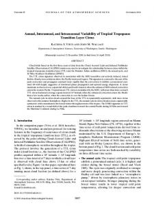
Fig. 2. Occupations of the JONSIS line: A by year and B by month. C Scottish and Norwegian stations on the JONSIS line.
Gaussian weighting function was used to interpolate the data onto a regular grid. Grid spacing was 0.01° (567 m) in the horizontal and 2 m in the vertical. Semivariograms were used to determine appropriate correlation length scales for the mapping process. Semivariograms quantify the dissimilarity (i.e. the semivariance) between observations as a function of the distance between them (Schaeffer et al., 2015). The maximum permissible correlation length scale is the distance at which dissimilarity ceases to increase with distance, although the correlation length scale may be set below this maximum (Janssen et al., 1999). The correlation length scales were 0.3° longitude (28.4 km) and 2 m in the horizontal and vertical respectively. These values are considerably less than the maximum possible correlation length scales, reflecting the need to use only the most closely correlated neighbouring data points in the interpolation, for instance, to preserve sharp thermoclines. Larger length scales produced temperature and salinity fields that were unrealistically smooth and which did not agree well with the nongridded observations. After the objective mapping process, in cases where the observations did not cover the entire water column, the deepest interpolated measurement was extrapolated to the seafloor using a fixed-value method; similarly, where necessary the shallowest interpolated measurement was extrapolated to the surface using a fixed-value method. Such extrapolations were carried out over a depth range of typically no more than 5 m, and extrapolations to the surface were always within the surface mixed layer. Bathymetry was extracted from the GEBCO dataset (GEBCO_08 grid, version 20100927, www.gebco.net. An example Marine Scotland section from September 1990 showing observations and the interpolated data is presented in Fig. 3. The instrumental and gridding errors are estimated to be two to three orders of magnitude smaller than the variability discussed in Sections 3–6. Hydrographic data are presented as seasonal (JFM, AMJ, JAS and OND) mean sections; volume transport is presented as monthly mean values. Geostrophic velocity and volume transport are calculated section by section, prior to averaging, rather than from seasonally averaged distributions of temperature and salinity. Geostrophic velo-
This study analyses 27 years of data from a hydrographic section in the northern North Sea. The annual cycle of non-wind-driven forcing of, and transport in, the Atlantic inflow is quantified from this newly compiled data set, and the separate roles played by temperature and salinity on the non-wind-driven forcing are investigated. 2. Methods The Joint North Sea Information System (JONSIS) line is a zonal section between 0°and 2.233°W at 59.28°N (Fig. 1). The section is occupied multiple times a year (Fig. 2) by Scottish research ships, which sample at 12 stations, and Norwegian research ships, which occupy a section at the same latitude known as the Orkney-Utsire line that crosses the entire North Sea; 8 stations on the Orkney-Utsire line fall between 0°and 2.233°W (Fig. 2). Temperature and salinity profiles from Scottish occupations were obtained from Marine Scotland's data archive; temperature and salinity profiles from Norwegian occupations were obtained from the online data portal of the International Council for the Exploration of the Sea (ICES) (www.ocean.ices.dk/HydChem). Scottish and Norwegian data were visually inspected to identify complete sections; isolated data points, sections with fewer than eight stations, sections with unevenly spaced stations, and sections with poor vertical resolution (i.e. profiles with measurements at greater than 1 m intervals, the standard being 1 m resolution) were rejected. The combined Scottish-Norwegian dataset comprises 122 sections, between December 1989 and April 2015 (Fig. 2). Data are available for every month apart from August; a limited number of sections are available for January, February and March, and only one section is available for June (Fig. 2). In situ temperature and practical salinity were converted into conservative temperature and absolute salinity respectively (IOC et al., 2010); all subsequent uses of temperature and salinity refer to these TEOS-10 variables. This definition of salinity gives values that are typically 0.2 higher than those reported in previous studies that used different definitions of salinity. An objective mapping technique (Bretherton et al., 1976; Denman and Freeland, 1985; Chereskin and Trunnell, 1996) based on a 122
Continental Shelf Research 138 (2017) 120–131
P.M.F. Sheehan et al.
Fig. 3. A comparison of raw and interpolated data for an exemplar section A Observations of conservative temperature (°C) and B observations of absolute salinity (g kg−1). C Optimally interpolated conservative temperature (°C) and D optimally interpolated absolute salinity (g kg−1).
Atlantic Multidecadal Oscillation (AMO) index, which characterises the interdecadal variability of sea-surface temperature in the Atlantic once the signal of anthropogenic climate change has been removed (Schlesinger and Ramankutty, 1994; Trenberth and Shea, 2006), was downloaded from NOAA's Earth System Research Laboratory (www. esrl.noaa.gov/psd/data/timeseries/AMO; un-smoothed product).
city is calculated relative to an assumed level-of-no-motion at the deepest common level between adjacent horizontal grid points. In order to assess the relative contributions that temperature and salinity make to this velocity, the components of geostrophic flow driven by the temperature and salinity distributions are also calculated. The temperature-driven component is defined as the geostrophic velocity calculated using the observed temperature distribution for a given section and an artificial salinity distribution in which salinity is constant in space. The salinity-driven component is defined as the geostrophic velocity calculated using the observed salinity distribution for a given section and an artificial temperature distribution in which temperature is constant in space. The constant salinity value is the spatial and temporal mean salinity calculated from all 122 sections (35.33 g kg−1); the constant temperature value is the spatial and temporal mean temperature calculated from all 122 sections (9.05 °C). So if geostrophic velocity, v, is a function of temperature, t, salinity, S and depth, z, the temperature-driven component is v(t , S , z ) and the salinity-driven component is v(t , S , z ) where an overbar denotes a spatial and temporal mean. The amplitudes and phases of the annual cycle of temperature, salinity and geostrophic velocity at each grid point are calculated using a harmonic analysis method (Thomson and Emery, 2014); the fitted (cos)sinusoids are required have a period of 365 days. This allows the construction of a sinusoidal annual cycle at each grid point for the three variables. Sampling a grid point's sinusoid at the time of each section and subtracting this value from the observed value permits the calculation of residual distributions of temperature, salinity and geostrophic velocity for each section. We will refer to these as deseasoned distributions. Similarly, a sinusoidal annual cycle of 365 days is fitted to the time series of volume transport, and the residual (deseasoned) time series calculated. The de-seasoned variables, once spatially averaged by section, are used to calculate the one-dimensional time series of section-mean temperature, section-mean salinity and section-integrated volume transport discussed in Section 6. Long-term trends were not removed from the data. The NAO index used in Section 6 was downloaded from NOAA's Climate Prediction Centre (www.cpc. ncep.noaa.gov/products/precip/CWlink/pna/nao.shtml), and the
3. Mean conditions over an annual cycle 3.1. Winter In winter, there is very little spatial variation in temperature, either horizontally or vertically (Fig. 4A). Consequently, the temperaturedriven component of the geostrophic flow is small: current speeds peak at approximately 1 cm s−1 flowing northward in the far west of the section. The horizontal salinity gradient is strong (Fig. 4B). Salinity increases from less than 35 g kg−1 at the western limit of the section to over 35.4 g kg−1 at the eastern limit. The strongest salinity gradient, the boundary between low-salinity coastal water and high-salinity water of Atlantic origin (Dooley, 1974; Turrell et al., 1990), is found west of 1.5°W. This salinity gradient drives a salinity-dependent geostrophic flow approximately 60 km wide with peak southward current speeds of over 4 cm s−1. The salinity-driven flow is at its strongest in March, when southward current speeds exceed 7 cm s−1 at the surface. This is caused by a strengthening of the horizontal salinity gradient between 1.5 and 2°W. The signal of the salinity-driven component is clearly visible in the depth-varying geostrophic flow (Fig. 4C). The weak temperature-driven component has little impact, despite flowing in the opposite direction. The identification of a marked horizontal salinity gradient across the JONSIS line in winter, particularly in March, and the attribution to this gradient of a defined depth-varying southward current, provides evidence of the winter-time non-wind-driven component of the Atlantic inflow proposed by Dooley (1983) but thought non-existent by Turrell (1992). However, contrary to the suggestion of Dooley (1983), this component is a narrow, near-coast feature, rather than being spread over too wide an area to be readily observed. 123
Continental Shelf Research 138 (2017) 120–131
P.M.F. Sheehan et al.
Fig. 4. Mean conditions in January, February and March. A Geostrophic velocity calculated using an assumed uniform salinity of 35.33 g kg−1 (shading; cm s−1); conservative temperature (contours; °C). B Geostrophic velocity calculated using an assumed uniform temperature of 9.05 °C (shading; cm s−1); absolute salinity (contours; g kg−1). C Geostrophic velocity (shading; cm s−1); density (contours; kg m−3). Negative velocity indicates southward flow.
3.2. Spring
The mean surface geostrophic currents are slower than those predicted by models when the influence of the wind is taken into account. Winther and Johannessen (2006), in a modelling study that includes wind-driven flow, find surface currents across the western part of the JONSIS line to be approximately 20 cm s−1 in February; in the east, current speeds are approximately 6 cm s−1. That such current speeds are not observed in the present study when wind forcing is not taken into account is consistent with the dominant role played by the wind in driving Atlantic inflow in winter.
In spring, thermal stratification begins to develop in the eastern half of the JONSIS line (Fig. 5A). The lack of stratification west of 1.5°W is evidence of the near-shore tidal mixing identified by Svendsen et al. (1991). The weak horizontal temperature gradient between the stratified and mixed regimes induces a weak, southward, temperature-driven component of the geostrophic flow, with maximum speeds of only 1 cm s−1. This temperature-driven flow strength-
Fig. 5. Mean conditions in April, May and June. Panels, shading, contours and units are as in Fig. 4.
124
Continental Shelf Research 138 (2017) 120–131
P.M.F. Sheehan et al.
3.3. Summer
ens as spring progresses. There is only one section available in June (Fig. 2), but this section has a temperature-driven flow faster (4 cm s−1) and wider (50 km) than the average presented here. Mean salinity in the far west of the section is higher than in winter, and a slight surface freshening leads to the development of a weak halocline east of 1.5°W (Fig. 5B). The increase in salinity in the west of the section is balanced by the westward expansion of high-salinity water, as demonstrated by the westward displacement of the 35.4 g kg−1 isohaline, rather than by a commensurate salinity increase in the east. This contradicts previous studies which found that the horizontal salinity gradient was kept constant by equal changes in the salinity across the FIC, rather than to changes to the extent of highand low-salinity waters (Turrell, 1992). The salinity-driven component of the geostrophic flow remains of a comparable speed to that in winter, but is narrower (approximately 40 km wide) and centred further east. In the June section, the salinity-driven flow is much weaker than this average, being 30 km wide and having a maximum speed of 2 cm s−1. The geostrophic flow observed in spring (Fig. 5C) is present as two separate cores with peak southward velocities of over 5 cm s−1, one centred at 2.1°W and the other at 1.6°W. The western core is driven by the salinity component. The eastern core is driven primarily by the salinity component, but with a contribution from the temperature component. An individual section may exhibit either one or both of the cores visible in the long-term mean. The temperature component appears to be responsible for the region of low velocity ( 0.05).
126
Continental Shelf Research 138 (2017) 120–131
P.M.F. Sheehan et al.
(Fig. 8). The amplitude of the annual cycle of salinity is highest (>0.1 g kg−1) at the surface east of 0.2°W (Fig. 8C) in the region that is most influenced by incursions of NCC water in the summer (Fig. 6; Sætre et al., 1988). Amplitude is also high (>0.08 g kg−1) at the seafloor around 2°W. This reflects the changing strength of the horizontal salinity gradient between coastal and Atlantic waters (Dooley, 1974) that occurs over an annual cycle. A horizontal gradient in standard deviation separates the relatively high-amplitude, high-variability region to the west from the region at depth to the east where salinity is less variable. That contours of standard deviation cross contours of amplitude around 1.5°W indicates that there is salinity variability at the surface that is not explained by the annual cycle. Maximum salinity in the east and west of the section occurs approximately six months out of phase (Fig. 8D): in the east, it occurs in February; in the west, it occurs in July and August. These results suggests that the amplitude of the annual cycle of salinity is not the same across the JONSIS line and that changes do not happen in phase; this contradicts previous studies based on limited data (Turrell, 1992). Changes in the strength of the salinity-driven geostrophic flow from month to month, although small, occur as a result of zonal differences in the amplitude and phase of the annual cycle of salinity. However, the correlation between the annual cycle and the observations is low (Fig. 8D), indicating that the annual cycle presented here explains only a small part (around 10%) of the observed variability. The correlation is strongest in the region of NCC influence to the east of the JONSIS line, which is likely explained by the strong influence that the lateral extent of this low-salinity water is known to have on the salinity of the northeastern North Sea (Marsh et al., 2017). In regions where the annual cycle of salinity is of low amplitude, the annual cycle does not provide a statistically significant fit to the observations at the 5% significance level. The annual cycle of geostrophic velocity has two regions of high amplitude (>2 cm s−1; Fig. 9A): the first west of 2°W, and the second centred at 1.2°W. The region of low variability in between is where annual mean geostrophic velocity (not shown) is highest: this is the location of the most persistent flow over an annual cycle. Both highamplitude regions are caused more by the annual cycle of the temperature-driven flow than by that of the salinity-driven flow, which is the less variable of the two (Fig. 9C and D). The temperature-driven flow is near negligible in winter but reaches speeds of over 5 cm s−1 in summer; consequently, regions where the greatest temperature-driven velocity is observed in summer are regions where the amplitude of the annual cycle of temperature-driven velocity is high. In contrast, the core of the salinity-driven flow is present throughout the year (Figs. 4– 7). It is therefore the annual cycle of the temperature-driven flow that is the greater determinant of the annual cycle of the overall geostrophic flow. The month of the velocity maximum becomes progressively later in the year with distance east along the JONSIS line (Fig. 9B). West of 1.6°W, maximum velocity is reached in July when the temperatureand salinity-driven components combine to produce a fast (8 cm s−1) flow. As temperature takes over as the principal driver of the geostrophic flow later in the year, the month of the velocity maximum shifts gradually eastwards as the location of the horizontal temperature gradient moves eastwards. In parts of the eastern limit of the section, maximum velocity does not occur until December. The annual cycle of geostrophic velocity and of the temperature- and salinity-driven components of geostrophic velocity provides a statistically significant fit to the observations in all but small parts of the JONSIS line (Fig. 9).
gradient (Turrell, 1992), and when stratification inhibits a barotropic response to wind forcing, it is the horizontal density gradient (Fig. 6C) that must adjust to changes in the overlying wind stress. Turrell et al. (1992) propose that northerly winds promote the inflow of highsalinity Atlantic water that, at the JONSIS line, sits beneath the thermocline (Fig. 6B). In turn, this strengthens the horizontal salinity gradient and so increases geostrophic flow. Conversely, they propose that southwesterly winds reduce the inflow of high-salinity Atlantic water and so weaken the horizontal salinity gradient (Turrell et al., 1992). Winther and Johannessen (2006) find that northerly winds lead to upwelling of approximately 0.5 m day−1 around the coast of the Shetland Islands, increasing northwards towards the shelf break. This, too, could bring high-salinity water of Atlantic origin into the northern North Sea. 3.4. Autumn Temperature stratification and salinity stratification weaken in the autumn (Fig. 7A and B). The horizontal gradients also weaken substantially, with a corresponding weakening of the temperatureand salinity-driven components of the geostrophic flow. Maximum temperature-driven speeds are 3 cm s−1; maximum salinity-driven speeds are 4 cm s−1. A reversal of the horizontal salinity gradient between 0.2 and 0.5°W induces a weak (1 cm s−1) northward flow at the same location. Month to month, as autumn progresses, the core of the temperature-driven flow moves eastward as the location of the horizontal temperature gradient moves offshore. The location of the salinity-driven flow remains largely unchanged. The maximum speed of the geostrophic flow is 5 cm s−1, but the flow is at its broadest (approximately 110 km) in autumn. The western part of the flow is driven by the salinity component; the eastern part of the flow is driven by the temperature component. The region of weaker flow at 0.2°W appears to be a result of the northward salinity-driven flow mentioned above. Results from the Autumn Circulation Experiment suggest that wind forcing switches from the summer, non-wind-driven regime to the winter, wind-driven regime in November and December (Turrell et al., 1990). By December, once stratification has decayed almost completely, greatest inflow is induced by southwesterly winds (Turrell et al., 1990). This suggests that a barotropic response to wind forcing is once again dominant by the end of autumn. 4. Amplitude and phase of the annual cycle High amplitudes (>2 °C) of the annual cycle of temperature (Fig. 8A) are found in regions that are subject to the greatest degree of warming in the summer: the well-mixed coastal region and the surface in the stratified region. These same regions have higher R2 values (>0.8; Fig. 8B), indicating that the annual cycle explains a greater portion of the observed variability in these regions than it does elsewhere, i.e. in the sub-thermocline region of Atlantic water. Maximum temperatures at the surface and in the mixed regions are reached in August and September (Fig. 8B). In the stratified region, maximum temperatures are reached progressively later with depth. At the seabed, east of 0.5°W, maximum temperature is not reached until December once stratification has broken down. In this region of Atlantic influence, where annual variability is lowest, the correlation between the derived annual cycle and the observations is at a minimum, indicating that processes other than the annual cycle of air temperature and insolation have a greater impact on the annual cycle of temperature here than they do elsewhere in the section. The annual cycle of temperature provides a statistically significant fit to the observations at all longitudes and depths of the JONSIS line. The strength of this fit is also reflected in the high degree of qualitative similarity between the distribution of the standard deviation of temperature and of the amplitude of the annual cycle of temperature
5. Transport of the Atlantic inflow Volume transport calculated from the bottom-referenced geostrophic shear across the JONSIS line (Fig. 10) is lowest in February (0.11 Sv) and highest in October (0.36 Sv). Surface velocity is highest in September, peaking at over 9 cm s−1; in October, maximum velocity 127
Continental Shelf Research 138 (2017) 120–131
P.M.F. Sheehan et al.
Fig. 9. Amplitude of the annual cycle of geostrophic velocity (shading; cm s−1) and standard deviation of geostrophic velocity (contours; cm s−1). B Phase of the annual cycle as month of maximum southward velocity (shading) and goodness of fit of the annual cycle (R2; contours). C Amplitude of the annual cycle of temperature-driven geostrophic velocity (shading; cm s−1), and standard deviation of temperature-driven geostrophic velocity (contours; cm s−1). D As for C, but for the annual cycle of salinity-driven geostrophic velocity. Grey dots cover regions where the annual cycle does not provide a statistically significant fit to the observations at the 5% significance level (i.e. p > 0.05).
is lower (7 cm s−1) than in September, but the flow is broader, offsetting the decline in velocity. The same is true of the temperature-driven transport: velocity peaks in September, but the broader current in October results in a higher temperature-driven transport. Maximum salinity-driven transport (0.14 Sv) occurs in January, when the salinity-driven flow is broad (approximately 90 km wide) and has a peak speed of approximately 5 cm s−1. The salinity-driven current reaches its maximum speed in March, but the narrowing of the salinity-driven current between January and March offsets the increase in transport that the increase in velocity would otherwise cause. The derived annual cycles of transport, of temperature-driven transport and of salinity-driven transport are also presented in Fig. 10. (Note that the derived annual cycles are calculated from the complete time series and not from the monthly means plotted in Fig. 10.) The derived annual cycle of transport explains 71.3% of variability in transport; the derived annual cycle of temperature-driven transport explains 86.0% of variability in the temperature-driven transport; and the derived annual cycle of salinity-driven transport explains 22.5% of variability in salinity-driven transport. The comparatively little variability in salinity-driven transport that is explained by its derived annual cycle suggests that, unlike the temperature-driven transport, the salinity-driven transport and the salinity distribution that drives it are not principally controlled by seasonally varying processes. All three derived annual cycles provide a statistically significant fit to the observations at the 1% level (i.e. p < 0.01).
However, some features of the monthly mean transports are not accurately represented by the derived annual cycles. The derived cycles greatly underestimate transport and temperature-driven transport in March, the derived cycles being more than one standard deviation away from the respective monthly mean value in both cases. In the case of temperature-driven transport, the derived annual cycle predicts a positive (i.e. northward) transport between February and April, which is unrealistic given the monthly mean values. The addition of higher harmonics, for instance, the addition of a semi-annual cycle, was not found to make an appreciable difference to the results. The annual cycle of transport is governed primarily by the annual cycle of the temperature-driven component. The greater amplitude of the cycle of temperature-driven transport compared with that of the salinity-driven transport, as well as the low proportion of the salinitydriven transport that is explained by its annual cycle, ensures that the annual cycle of transport most closely follows that of its temperaturedriven component. Salinity-driven transport, while amplifying the temperature-driven transport throughout the year, nevertheless becomes the principal driver of thermohaline flow between January and May, maintaining a thermohaline forcing of the Atlantic inflow at a time when horizontal temperature gradients are almost negligible. The monthly mean transport results presented above are in broad agreement with those of Turrell et al. (1990), which were derived from current meters. They estimate a non-wind-driven transport of 0.3– 0.4 Sv in the FIC for periods of low wind speed (