Virtual Geographic Environment Based Coach Passenger Flow Forecasting
arXiv:1504.01057v1 [cs.SI] 4 Apr 2015
Zhihan Lv1 , X iaoming Li1,2,3 , Jinxing Hu1 , Ling Yin1 , Baoyun Zhang4, Shengzhong Feng1 1. Shenzhen Institute of Advanced Technology(SIAT), Chinese Academy of Science, Shenzhen 2. Shenzhen Research Center of Digital City Engineering, Shenzhen, China 3. Key Laboratory of Urban Land Resources Monitoring and Simulation, Ministry of Land and Resources, Shenzhen, China 4. Jining Institute of Advanced Technology(JIAT), Chinese Academy of Sciences, Jining Email:
[email protected] Abstract—There are lacks of integrated analysis and visual display of multiple real-time dynamic traffic information. This research proposed a deep research and application examples on this basis which is conducted in virtual geographic environment. Currently, there are many kinds of traffic passenger flow forecasting models, and the common models include regression forecasting model and time series prediction model. The coach passenger flow shows strong regularity and stability without longterm change trend, so this research adopts regression forecasting model to forecast the coach passenger flow. Keywords—WebVRGIS; Passenger Flow Forecasting; Virtual Geographical Environment; HCI
I.
I NTRODUCTION
That long-distance passenger flow refers to the passenger flow by long-distance coach. Long-distance passenger flow is the meaning of space areas, refers to the passenger flow of long distance travel, and the specific distance boundary is uncertain, which is just the agreed within the boundary. For the transport sectors located in major cities, those of 10km above are called long distance; and for those located in small towns or rural areas, 30-50km above is also known as long distance. As an important part of urban transportation system, the urban passenger terminal is an important joint-point for urban internal traffic and external traffic [42]. It integrates transportation routes including many highways and urban roads, multiple means of transportation, has necessary service function and control equipments, and also has the comprehensive infrastructure which provides places for urban internal and external traffic transition and integrates with traffic, commerce, and leisure. The urban passenger terminal often gives a comprehensive consideration on urban external highway passenger transportation and urban public traffic (track, bus, and taxi, etc.), private transportation, as well as railway, aviation, and other external passenger transportation to establish an organic passenger transportation and bring important benefits to urban development [28]. With evolution and outward extension of urban spatial structure, the lines of public transportation are continuously expanded and extended; meanwhile, the means of transportation also develop in a diversified way. The reasonable planning and design and efficient management on urban passenger terminal are the important link to improve urban public transportation
system, solve residents transfer, and improve the service quality and operation benefits of public transportation [8]. Nowadays, there is an increasing interest in creating Virtual Reality Geographical Information System (VRGIS), which can obtain the landscape geospatial data dynamically, as well as perform rich visual 3D analysis, calculations, managements based on Geographical Information System (GIS) data. Accordingly, ’3-D modes’ has been proved as a faster decision making tool with fewer errors [29]. A parallel trend, the utilize of bigdata is becoming a hot research topic rapidly recently [1]. GIS data has several characteristics, such as large scale, diverse predictable and real-time, which falls in the range of definition of Big Data [3]. Besides, to improve the accuracy of modeling, the city planning has an increasingly high demand for the realistic display of VR system, however this will inevitably lead to the growth of the volume of data. Virtual scene from a single building to the city scale is also resulting in the increased amount of data. Beside spatial data integration, new user interfaces for geo-databases is also expected [2]. Therefore, the management and development of city big data using virtual reality technology is a promising and inspiring approach. II.
S YSTEM
Currently, there are lacks of integrated analysis and visual display of multiple real-time dynamic traffic information, and also lacks of deep research and application examples on this basis. This research takes Shenzhen Futian comprehensive transportation junction as the case, and makes use of continuous multiple real-time dynamic traffic information (including taxi and floating car data, card swiping data of public transport, and long-distance passenger traffic information, etc.) to carry out monitoring and analysis on spatial and temporal distribution of passenger flow under different means of transportation and service capacity of junction from multi-dimensional spacetime perspectives such as different period and special period. In this work, we utilize 3D Shenzhen as a convincing case to present WebVRGIS [24], which is based on WebVR render engine [27]. Shenzhen is a thirty-years new city, however, it has the highest population density in China, which reaches 7785 people per square kilometer (2013). It causes some embarrassments to the city information management [16]. While virtual environments have proven to significantly improve public understanding of 3D planning data [6]. To share
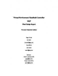
Fig. 1. Left: OD analysis; Right: Passenger flow forecast of various stations
of information resources of all departments and the dynamic tracking for the geospatial information of population and companies, by construction an integrated information platform of social services. The use of virtual reality as visual means changed the traditional image of the city [7]. The geographic statistical analysis is to assist management decision-making and conduct data analysis. The 2D statistical analysis visualization is overlapped with a white background on 3D virtual reality environment, since it’s more intuitive and a cognitively less demanding display system, which lessens the cognitive workload of the user [29]. The innovation points of this work include, real-time dynamic comprehensive transportation data mining, three-dimensional GIS analysis and release as for transportation junction; Carry out comprehensive assessment on service scope of junction through analyzing long-term dynamic traffic data; Carry out comprehensive analysis on actual travel time and then comprehensive assessment on service capacity of public transportation (accessibility and reliability). III.
C OACH
PASSENGER FLOW FORECASTING
Shenzhen Futian comprehensive transfer junction is the first comprehensive transportation junction with car harbor function in Shenzhen City: the usable areas for long-distance passenger transportation, public transportation, and taxis are 50, 000m2, 29, 000m2, and2, 310m2 respectively. It is planned that the daily transfer volume of bus and metro is 250,000 person-times; the number of long-distance departure places is 51, the daily departure volume of long-distance passenger transportation is more than 2,000 shifts, the average daily departure volume is 70,000 person-times, and the peak is 100,000 person-times; the number of urban bus lines is 30; the average daily passenger transfer capacity is 350,000 persontimes. Futian Transportation Hub Station is the integrated hub of the provincial and inter-provincial long-distance passenger transportation and the transit passenger distribution for Luohu Huanggang two major ports. The departure long-distance lines has covered 13 provinces as Guangdong, Fujian, Zhejiang, Shanghai, Jiangxi, Jiangsu, Hainan Sichuan, Guangxi, Hunan, Hubei, Shandong, Hong Kong SAR and 21 cities and counties within the province such as Guangzhou, Zhongshan, Zhuhai, Meizhou, Shanwei and others, with the average daily numbers of run about 720. The following two figures show the inter-city and inter-province service range of Futian Transportation Hub long-distance passenger station; it undertakes the long-distance passenger task of Shenzhen to most areas inside and outside the province, and the service capabilities can basically meet the long distance travel needs of the people of Shenzhen.
There are many kinds of traffic passenger flow forecasting models, and the common models include regression forecasting model and time series prediction model [14] [17]. In the observation period of this research, the coach passenger flow shows strong regularity and stability without long-term change trend; therefore, this research adopts regression forecasting model to forecast the coach passenger flow. While we forecast the passenger flow, there may be many independent variables which have influence on the result of dependent variable (passenger flow), but the actual situation is that it is only allowed to find out several independent variables which have important influence on the dependent variable and ignore other independent variables. In specific application, it is required to screen out some main independent variables which cause influence on the result of dependent variable for research and analysis, and the analysis of variance theory is applied in this screen-out process. The analysis of variance is a kind of statistical analysis method in which the analysis and processing is made for significance of difference in mean values of some sets of experimental data. The passenger flow samples are different in different periods in each day; therefore, it is able to know that the date and period are 2 variables which influence passenger flow; through dual-factor analysis of variance, it is able to determine whether these two factors are important factors which influence passenger flow and then regard them as input variables in later forecasting analysis if so. Due to difference in inbound and outbound coach passenger flow, this research carries out forecasting modeling and model validation on inbound and outbound passenger flow respectively. We have got the numbers of long-distance passenger run of Futian long-distance passenger station from July to October; the data information includes long-distance coach license plate number, starting location and time of departure, terminal, distance, fare, long-distance type, number of passengers, rated number of passengers and other information, we figured out the number of different types of long-distance passenger every day Through the statistics for four months of long-distance passenger flow in the long-distance passenger station, it was found that the long-distance passenger flow was generally showing a periodic law, namely the passenger flow trough appears from Monday to Thursday, and passenger flow peak appears on Friday and Saturday, suggesting Futian transportation hub station serves mainly for local people travel; and it has been proved in the later mid-Autumn Festival and National Day Golden week holiday, and the holiday passenger flow peak appeared on the day before holiday, while no passenger flow peak appeared in end of holiday, indicating Futian transportation hub station mainly undertakes local people travel, rather than nonlocal passenger flow, business passenger travel. Through the passenger whereabouts statistics, it was found the passenger whereabouts of Futian long-distance passenger station is mainly the cities inside Guangdong province, and meanwhile there is a basic feature for every day long-distance flow: From Monday to Thursday, two peaks appeared every day, respectively from 9:00 -10:00am and 5:00 -6:00pm, and the number of morning peak is larger than the evening peak;
TABLE I.
R ESULTS OF REPEATABLE DOUBLE FACTOR VARIANCE ANALYSIS OF OUTBOUND TRAFFICS FROM M ONDAY TO S UNDAY
TABLE II.
R EGRESSION MODELING RESULTS OF OUTBOUND TRAFFICS AT TIME PERIOD FROM M ONDAY TO T HURSDAYREGRESSION STATISTICAL RESULTS
Source of Difference
SS
df
MS
F
P-value
F crit
Regression
Sample Row Interactive Internal Total
1422089 40031779 2593351 13881166 57928385
6 16 96 1309 1427
237014.8 2501986 27014.08 10604.4
22.3506 235.9384 2.547439
3.62E-25 0 2.8E-13
2.105496 1.651239 1.260871
Multiple R R Square Adjusted R Square Standard Error Observed Value
the same two peaks appeared on Friday to Sunday, but the number of evening peak is larger than morning peak, indicating that the major travel purpose of passenger crowd in Futian long-distance passenger station is relatives-visiting flow and business trip flow within the province The shift of long-distance passenger transportation is fixed, so its passenger flow has great relevance to people activity pattern; due to the people activity pattern is a weekly cycle, the passengers for tourism and relatives-visiting of long-distance travel mostly select weekends, and for business travel, they select weekdays; so long-distance all day passenger flow with different lines indicates regular changes within a week. So we chose a weekly cycle to conduct analysis of the changes in long-distance passenger flow, and predict the long-distance passenger flow within a week. We used regression prediction method to predict the longdistance passenger flow changes of Futian transportation hub. We have now mastered the passenger flow data of Futian transportation hub long-distance station in July, August, September and October, but due to the impact of Universiade in August, Mid-Autumn Festival in September, National Day holiday in October, we chose the complete data of July as training sample to predict the passenger flow in August For outbound traffic, predictive modeling and model validation contain the following steps: 1. Outbound traffics of four weeks with normal data at each time period in July are selected as modeling samples. 2. All modeling samples are of repeatable double factor variance analysis in terms of day of week and time period, and results are as follows: According to Table I, the sample group has p − value = 3.62E − 25 ≫ 0.05, and thus its traffics have significant difference, i.e. outbound traffics at different time periods from Monday to Sunday have significant difference; traffic of each time period within the group p − value ≫ 0.05, and so there is also significant difference among outbound traffics at all time periods within the group. Thus, both day of week and time period can be considered as influencing factors of outbound traffic. 3. To further test differences in traffic changes within a week, this study carries out repeatedly combined double factor variance analysis and finds: significant difference in outbound traffics at time period from Monday to Sunday. 4. Based on the above analysis, regression models are established with respect to outbound traffics at different time periods from Monday to Sunday. This study divides time period into 16 parts, and makes time period variable become a categorical independent variable with 16 types, and thus
0.850582 0.723491 0.699924 105.6651 192
TABLE III. R EGRESSION MODELING RESULTS OF OUTBOUND TRAFFICS AT TIME PERIOD FROM M ONDAY TO T HURSDAYVARIANCE ANALYSIS RESULTS
Regression Analysis Residual Error Total
df
SS
MS
F
Significance F
15
5141604
342773.6
30.70041
2.84E-41
176 191
1965060 7106664
11165.11
15 dependent variables are generated. These four regression models are expressed as follows: (1) Outbound traffics on Monday: Flow out Mon = a1t1 + a2t2 + a3t3 + a4t4 + a5t5 + a6t6 + a7t7 + a8 (2) Outbound traffics on Tuesday: Flow out Tue = b1t1 + b2t2 + b3t3 + b4t4 + b5t5 + b6t6 + b7t7 + b8 (3) Outbound traffics on Wednesday: Flow out Wed = c1t1 + c2t2 + c3t3 + c4t4 + c5t5 + c6t6 + c7t7 + c8 (4) Outbound traffics on Thursday: Flow out T hu = d1t1 + d2t2 + d3t3 + d4t4 + d5t5 + d6t6 + d7t7 + d8 (2) Outbound traffics on Friday: Flow out Fri = e1t1 + e2t2 + e3t3 + e4t4 + e5t5 + e6t6 + e7t7 + e8 (2) Outbound traffics on Saturday: Flow out Sat = f1t1 + f2 t2 + f3t3 + f4t4 + f5t5 + f6t6 + f7t7 + f8 (2) Outbound traffics on Sunday: Flow out Sun = g1t1 + g2t2 + g3t3 + g4t4 + g5t5 + g6t6 + g7t7 + g8 Where, t1 ,t2 , . . .t15 are dependent variables of 16 time periods. When t1 = 1,t2 = t3 = . . . = t15 = 0, dependent variables denote outbound traffics of the first time period; when t2 = 1,t1 = t3 = . . . = t15 = 0, dependent variables denote outbound traffics of the second time period; reason by analogy; when t1 = t2 = t3 = . . . = t15 = 0, dependent variables denote outbound traffics of the eighth time period. ai , bi , ci , di , ei , fi , gi are independent variable parameters and constant terms of these seven models respectively. 5. By modeling with sample data in Table II, results of predictive model of outbound traffics at time period from Monday to Thursday are as follows: According to Table II, predictive model of outbound traffics on Monday has Adjusted R Square=72.35%, i.e. this model can explain 72.35% of sample data; the entire model has statistical significance at level α = 0.05; all parameters of the model have p-value smaller than 0.05, which means that all of these parameters have statistical significance at level α = 0.05. Similarly, modeling results of outbound traffics at time periods from Tuesday to Sunday are as follows: predictive model of outbound traffics on Tuesday has Adjusted R Square=81.7% and statistical significance at level α = 0.05, and all of its
TABLE V.
TABLE IV.
R EGRESSION MODELING RESULTS OF OUTBOUND TRAFFICS AT TIME PERIOD FROM M ONDAY TO T HURSDAYMODEL COEFFICIENT RESULTS
Intercept X Variable X Variable X Variable X Variable X Variable X Variable X Variable X Variable X Variable X Variable X Variable X Variable X Variable X Variable X Variable
1 2 3 4 5 6 7 8 9 10 11 12 13 14 15
Coefficients
Standard Error
t Stat
P-value
66.5 -8.25 270.5833 544.3333 607 425 284.8333 295.4167 330.5 350.4167 326.4167 336.9167 309.0833 243.0833 145.5833 90.41667
30.50289 43.1376 43.1376 43.1376 43.1376 43.1376 43.1376 43.1376 43.1376 43.1376 43.1376 43.1376 43.1376 43.1376 43.1376 43.1376
2.180122 -0.19125 6.272564 12.61854 14.07125 9.852195 6.602902 6.848241 7.66153 8.123231 7.566872 7.810279 7.165057 5.635069 3.37486 2.096006
0.030576 0.848551 2.67E-09 2.05E-26 1.28E-30 1.63E-18 4.59E-10 1.2E-10 1.18E-12 7.69E-14 2.05E-12 4.94E-13 2.05E-11 6.83E-08 0.000909 0.037512
VALIDATION RESULTS OF PREDICTIVE MODEL OF SUBWAY OUTBOUND TRAFFICS AT DIFFERENT TIME PERIODS Maximum Error
Minimum Error
Mean Error
20.85%
0.89%
9.92%
(4) Outbound traffics on Thursday: Flow out T hu −43.92t1 + 198.33t2 + 451.92t3 + 479.83t4 + 352.67t5 235.50t6 + 248.75t7 + 305.17t8 + 305.83t9 + 284.00t10 254.08t11 + 247.25t12 + 211.75t13 + 106.58t14 + 67.42t15 71.17
= + + +
(5) Outbound traffics on Friday: Flow out Fri = −67.42t1 + 145.67t2 + 408.50t3 + 444.67t4 + 339.50t5 + 227.42t6 + 262.42t7 + 326.25t8 + 348.08t9 + 380.92t10 + 441.25t11 + 423.33t12 + 469.08t13 + 340.67t14 + 187.08t15 + 101.67
parameters except p − value − b1 = 0.18 have p-value smaller than 0.05; predictive model of outbound traffics on Wednesday has Adjusted R Square=77.3% and statistical significance at level α = 0.05, and all of its parameters except p − value− c1 = 0.08 have p-value smaller than 0.05; predictive model of outbound traffics on Thursday has Adjusted R Square=74.2% and statistical significance at level α = 0.05, and all of its parameters except p−value−d1 = 0.21 have p-value smaller than 0.05; predictive model of outbound traffics on Friday has Adjusted R Square=77.6% and statistical significance at level α = 0.05, and all of its parameters except p − value − e1 = 0.056 have p-value smaller than 0.05; predictive model of outbound traffics on Saturday has Adjusted R Square=71.1% and statistical significance at level α = 0.05, and all of its parameters except p − value− f1 = 0.38 and p − value − f15 = 0.09 have p-value smaller than 0.05; predictive model of outbound traffics on Friday has Adjusted R Square=54.5% and statistical significance at level α = 0.05, and all of its parameters except p−value−g1 = 0.61 and p − value − g13 = 0.18 have p-value smaller than 0.05; To sum up, predictive models of outbound traffics at four time periods from Monday to Sunday have good imitative effects of sample data and are expressed as follows: (1) Outbound traffics on Monday: Flow out Mon −8.25t1 + 270.58t2 + 544.33t3 + 607.00t4 + 425.00t5 284.83t6 + 295.42t7 + 330.50t8 + 350.42t9 + 326.42t10 336.92t11 + 309.08t12 + 243.08t13 + 145.58t14 + 90.42t15 66.50
= + + +
(2) Outbound traffics on Tuesday: Flow out Tue −38.25t1 + 188.50t2 + 450.83t3 + 499.75t4 + 343.5t5 245.67t6 + 269.92t7 + 280.17t8 + 304.33t9 + 273.25t10 355.50t11 + 286.17t12 + 258.33t13 + 119.42t14 + 96.67t15 70.83
= + + +
(3) Outbound traffics on Wednesday: Flow out Wed = −58.83t1 + 177.67t2 + 428.17t3 + 524.92t4 + 330.75t5 + 261.67t6 + 251.33t7 + 286.83t8 + 298.08t9 + 301.92t10 + 363.33t11 + 308.33t12 + 281.5t13 + 148.42t14 + 93.92t15 + 87.08
(6) Outbound traffics on Saturday: Flow out Sat −42.00t1 + 228.42t2 + 570.50t3 + 593.33t4 + 416.92t5 321.17t6 + 287.33t7 + 382.08t8 + 397.33t9 + 398.42t10 415.83t11 + 349.00t12 + 307.58t13 + 143.42t14 + 80.00t15 70.33
= + + +
(7) Outbound traffics on Sunday: Flow out Sun = −34.75 + 220.92t2 + 552.83t3 + 530.00t4 + 383.50t5 + 270.50t6 + 280.58t7 + 347.00t8 + 382.17t9 + 459.75t10 + 546.83t11 + 4522.25t12 + 457.17t13 + 281.83t14 + 159.08t15 + 63.25 Outbound traffics at time periods with normal data within a week of August are selected as model validation samples, and such data includes: Validate prediction formula with validation samples and calculate the accuracy of each independent predicted value with absolute percentage error (APE): APE = 100% × kpredictedvalue − actualvaluek/actualvalue. Validation results are as Table V. As can be known from Table IV, the mean error of predictive model of subway outbound traffics at different time periods is 7.88%, and thus this model has good validation effects. IV.
G RAPHIC U SER I NTERFACE
Geographic human-computer interaction (GeoHCI) is becoming a hot-topic in CHI community [11]. The research of urban interaction on ubiquitous context [10] [30] [33] [32] have inspired our work. With a 3D earth model as the browser, this system is loaded with all 3D model data and the 3D visualization analysis result. By selecting the house inquiry, it is possible to find out the information of the address and owner, and to locate the house in the 3D scene. 3D roaming function can not only conduct soaring top view observation above the virtual community [19] [39], but can also observe the detailed layout near the street, and further enter the building to observe the internal building structure. The system also support ocean data visualization [31] [25] [26], which has potential to extend to ocean traffic forcasting system. Some novel interaction approaches are considered to integrate in our future work [18] [22] [21]. The separated core technology of our system also has potential to be applied into other fields, such as climate [34], biology [35], clinical assist [20]. Some
novel interaction approaches are considered to be integrated in our future work [18] [22] [21]. The new network data management algorithm [36] [37] [13], spatiotemporal database model [41], smart grid system [5] [4], neural network [12], data classification method [9], pedestrian detector technology [38] and stereoscopic 3D visualization approach [40] will be also considered. V.
C ONCLUSION
This research takes Futian transportation junction as research objective, and finds the spatial and temporal distribution rules of passenger flow and service scope of junction of all means of transportation via carring out statistical analysis on long-term daily passenger flow and daily time-phased passenger flow of metro, urban bus, taxi, and long-distance passenger transportation in Futian transportation junction according to the data such as Shenzhen TransCard data, taxi and floating car data, and long-distance passenger transportation data, as well as carries out a short-term forecasting on various kinds of passenger flow. Furthermore, the key analysis is made on abnormal traffic condition in the period of Universiade and National Day holidays. It is found via research that Futian transportation junction currently has good operation condition, and the passenger flow of various means of transportation doesnt reach the designed upper limit of passenger flow even in peak of passenger flow in holidays, without obvious transfer and congestion. Within short term, various means of transportation have stable passenger flow, and the time-phased passenger prediction model is reliable. The main service group of junction is distributed in west of Nanshan District and Futian District, as well as west of Luohu District and the scope which radiates about 9km based on the junction. Then, the travel time is used as index to carry out a series of research and analysis on accessibility of public transportation and taxis of Futian transportation junction. It is found via research that the junction based on metro and taxis has good accessibility, and the junction based on urban bus has poor accessibility at the peak in morning and evening, and they can supplement each other to certain degree. Then, the actual fluctuation of travel time is taken as index to carry out analysis on reliability of junction network based on metro and taxis respectively. It is found that the overall reliability of metro is high, and there is only poor reliability at the peak travel time at Huaqiang North station and Baoan center station; the reliability based on taxis declines with distance; as for some business centers and hot working area, there is poor reliability at the peak travel time; as for places with strong entertainment such as Overseas Chinese Town and Honey Lake, there is a poor reliability at travel time in holidays. The 3D Shenzhen case proves 3D city visualization and analysis platform is a useful tool for the social service agencies and citizens for browsing and analyzing city big data directly, and is agreed upon as being both immediately useful and generally extensible for future applications [23] [15]. VI.
under the condition of combing with economic development and urban planning. The analysis is made on population travel behavior, taxi route, degree of influence on public bus, and road travelling speed under special weather conditions (such as rainstorm, typhoon, and heavy fog, etc.) The deeper data mining is made, such as emergency evacuation aided decision support, monitoring and forecasting on large-scale group event, assisting crowd and vehicle evacuation under emergency.
F UTURE W ORK
Through long-term monitoring and analysis, the long-term transportation junction demand model, and long-term passenger flow forecasting and early-warning model are established
ACKNOWLEDGMENTS The authors are thankful to the National Natural Science Fund for the Youth of China (41301439) and Shenzhen Scientific & Research Development Fund (JC201105190951A, JC201005270331A, CXZZ20130321092415392), Electricity 863 project(SS2015AA050201). R EFERENCES [1] Big data specials. Nature, 455(7209), Sept. 2008. [2] M. Breunig and S. Zlatanova. Review: 3d geo-database research: Retrospective and future directions. Comput. Geosci., 37(7):791–803, July 2011. [3] F. Briggs. Large data - great opportunities. Presented at IDF2012, Beijing, 2012. [4] L. Che, M. Khodayar, and M. Shahidehpour. Adaptive protection system for microgrids: Protection practices of a functional microgrid system. IEEE Electrification Magazine, 2(1):66–80, 2014. [5] L. Che and M. Shahidehpour. Dc microgrids: Economic operation and enhancement of resilience by hierarchical control. IEEE Transactions Smart Grid, 5(5):2517–2526, 2014. [6] E. Chow, A. Hammad, and P. Gauthier. Multi-touch screens for navigating 3d virtual environments in participatory urban planning. In CHI ’11 Extended Abstracts on Human Factors in Computing Systems, CHI EA ’11, pages 2395–2400, New York, NY, USA, 2011. ACM. [7] C. DiSalvo and J. Vertesi. Imaging the city: Exploring the practices and technologies of representing the urban environment in hci. In CHI ’07 Extended Abstracts on Human Factors in Computing Systems, CHI EA ’07, pages 2829–2832, New York, NY, USA, 2007. ACM. [8] A. Etches, D. Parker, S. Ince, and P. James. Utis (urban transportation information system) a geo-spatial transport database. In Proceedings of the 8th ACM International Symposium on Advances in Geographic Information Systems, GIS ’00, pages 83–88, New York, NY, USA, 2000. ACM. [9] H. Fei and J. Huan. Structured sparse boosting for graph classification. ACM Transactions on Knowledge Discovery from Data (TKDD), 9(1):4, 2014. [10] P. T. Fischer and E. Hornecker. Urban hci: Interaction patterns in the built environment. In Proceedings of the 25th BCS Conference on Human-Computer Interaction, BCS-HCI ’11, pages 531–534, Swinton, UK, UK, 2011. British Computer Society. [11] B. Hecht, J. Sch¨oning, M. Haklay, L. Capra, A. J. Mashhadi, L. Terveen, and M.-P. Kwan. Geographic human-computer interaction. In CHI ’13 Extended Abstracts on Human Factors in Computing Systems, CHI EA ’13, pages 3163–3166, New York, NY, USA, 2013. ACM. [12] D. Hu, X. Zhang, Z. Xu, S. Ferrari, and P. Mazumder. Digital implementation of a spiking neural network (snn) capable of spiketiming-dependent plasticity (stdp) learning. In Nanotechnology (IEEENANO), 2014 IEEE 14th International Conference on, pages 873–876. IEEE, 2014. [13] D. Jiang, Z. Xu, P. Zhang, and T. Zhu. A transform domain-based anomaly detection approach to network-wide traffic. Journal of Network and Computer Applications, 40:292–306, 2014. [14] H.-Z. Li, S. Guo, C.-J. Li, and J.-Q. Sun. A hybrid annual power load forecasting model based on generalized regression neural network with fruit fly optimization algorithm. Know.-Based Syst., 37:378–387, Jan. 2013.
[15]
[16]
[17]
[18]
[19]
[20]
[21]
[22]
[23]
[24]
[25] [26]
[27] [28]
[29]
[30]
[31]
[32]
[33]
[34]
[35]
X. Li, Z. Lv, J. Hu, B. Zhang, L. Yin, C. Zhong, W. Wang, and S. Feng. Traffic management and forecasting system based on 3d gis. In Cluster, Cloud and Grid Computing (CCGrid) , 2015 15th IEEE/ACM International Conference on. IEEE, 2015. X. Li, Z. Lv, B. Zhang, W. Wang, S. Feng, and J. Hu. Webvrgis based city bigdata 3d visualization and analysis. In Visualization Symposium (PacificVis), 2015 IEEE Pacific. IEEE, 2015. K.-P. Lin, P.-F. Pai, Y.-M. Lu, and P.-T. Chang. Revenue forecasting using a least-squares support vector regression model in a fuzzy environment. Inf. Sci., 220:196–209, Jan. 2013. Z. Lv. Wearable smartphone: Wearable hybrid framework for hand and foot gesture interaction on smartphone. In 2013 IEEE International Conference on Computer Vision Workshops, pages 436–443. IEEE, 2013. Z. Lv, G. Chen, C. Zhong, Y. Han, and Y. Y. Qi. A framework for multi-dimensional webgis based interactive online virtual community. Advanced Science Letters, 7(1):215–219, 2012. Z. Lv, C. Esteve, J. Chirivella, and P. Gagliardo. A game based assistive tool for rehabilitation of dysphonic patients. In Virtual and Augmented Assistive Technology (VAAT), 2015 3nd Workshop on. IEEE, 2015. Z. Lv, L. Feng, S. Feng, and H. Li. Extending touch-less interaction on vision based wearable device. In Virtual Reality (VR), 2015 iEEE. IEEE, 2015. Z. Lv, L. Feng, H. Li, and S. Feng. Hand-free motion interaction on google glass. In SIGGRAPH Asia 2014 Mobile Graphics and Interactive Applications. ACM, 2014. Z. Lv, X. Li, B. Zhang, W. Wang, J. Hu, and S. Feng. Big city 3d visual analysis. In Eurographics 2015-Posters. The Eurographics Association, 2015. Z. Lv, S. Rhman, and G. Chen. Webvrgis: A p2p network engine for vr data and gis analysis. In M. Lee, A. Hirose, Z.-G. Hou, and R. Kil, editors, Neural Information Processing, volume 8226 of Lecture Notes in Computer Science, pages 503–510. Springer Berlin Heidelberg, 2013. Z. Lv and T. Su. 3d seabed modeling and visualization on ubiquitous context. In SIGGRAPH Asia 2014 Posters, page 33. ACM, 2014. Z. Lv, T. Su, X. Li, and S. Feng. 3d visual analysis of seabed on smartphone. In Visualization Symposium (PacificVis), 2015 IEEE Pacific. IEEE, 2015. Z. Lv, T. Yin, Y. Han, Y. Chen, and G. Chen. Webvr–web virtual reality engine based on p2p network. Journal of Networks, 6(7), 2011. H. J. Miller and Y.-H. Wu. Gis software for measuring space-time accessibility in transportation planning and analysis. Geoinformatica, 4(2):141–159, June 2000. T. Porathe and J. Prison. Design of human-map system interaction. In CHI ’08 Extended Abstracts on Human Factors in Computing Systems, CHI EA ’08, pages 2859–2864, New York, NY, USA, 2008. ACM. E. Reponen, J. Ker¨anen, and H. Korhonen. World-wide access to geospatial data by pointing through the earth. In CHI ’10 Extended Abstracts on Human Factors in Computing Systems, CHI EA ’10, pages 3895–3900, New York, NY, USA, 2010. ACM. T. Su, Z. Lv, S. Gao, X. Li, and H. Lv. 3d seabed: 3d modeling and visualization platform for the seabed. In Multimedia and Expo Workshops (ICMEW), 2014 IEEE International Conference on, pages 1–6. IEEE, 2014. J. Tan, F. Deng, et al. Design and key technology of urban landscape 3d visualization system. Procedia Environmental Sciences, 10:1238–1243, 2011. J. Tan, X. Fan, and Y. Ren. Methodology for geographical data evolution: three-dimensional particle-based real-time snow simulation with remote-sensing data. Journal of Applied Remote Sensing, 8(1):084598– 084598, 2014. Y. Tang, S. Zhong, L. Luo, X. Bian, W. E. Heilman, and J. Winkler. The potential impact of regional climate change on fire weather in the united states. Annals of the Association of American Geographers, 105(1):1–21, 2015. A. Tek, B. Laurent, M. Piuzzi, Z. Lu, M. Chavent, M. Baaden, O. Delalande, C. Martin, L. Piccinali, B. Katz, et al. Advances in human-protein interaction-interactive and immersive molecular simulations. Biochemistry, Genetics and Molecular Biology”Protein-Protein InteractionsComputational and Experimental Tools’, pages 27–65, 2012.
[36]
[37]
[38] [39]
[40]
[41]
[42]
Y. Wang, W. Jiang, and G. Agrawal. Scimate: A novel mapreducelike framework for multiple scientific data formats. In Cluster, Cloud and Grid Computing (CCGrid), 2012 12th IEEE/ACM International Symposium on, pages 443–450. IEEE, 2012. Y. Wang, A. Nandi, and G. Agrawal. Saga: Array storage as a db with support for structural aggregations. In Proceedings of the 26th International Conference on Scientific and Statistical Database Management, SSDBM ’14, pages 9:1–9:12, New York, NY, USA, 2014. ACM. J. Xu, D. Vazquez, A. M. Lopez, J. Marin, and D. Ponsa. Learning a part-based pedestrian detector in a virtual world. 2014. M. Zhang, Z. Lv, X. Zhang, G. Chen, and K. Zhang. Research and application of the 3d virtual community based on webvr and ria. Computer and Information Science, 2(1):P84, 2009. Y. Zhang, G. Jiang, M. Yu, and K. Chen. Stereoscopic visual attention model for 3d video. In Advances in Multimedia Modeling, pages 314– 324. Springer Berlin Heidelberg, 2010. C. Zhong, T. Wang, W. Zeng, and S. M. Arisona. Spatiotemporal visualisation: A survey and outlook. In Digital Urban Modeling and Simulation, pages 299–317. Springer, 2012. X. Zhou, D. Di, X. Yang, and D. Wu. Location optimization of urban passenger transportation terminal. In Proceedings of the 2010 International Conference on Optoelectronics and Image Processing Volume 01, ICOIP ’10, pages 668–671, Washington, DC, USA, 2010. IEEE Computer Society.