Sensor field produce diagnostic data, small size and slow rate: ... synchronous sleep/wakeup cycle bound to radio protocols ... PickCell: image analysis and ... UHF/VHF. S'Band. Lora. Antenna& 50&cm&+&6&m 50&cm&+&6&m 50&cm&+ ...
Bernard Pottier, 6 Juillet 2015
Wireless sensor networks and satellite simulation
1
Pierre-Yves Lucas, NGuyen Van Long, Tuyen Phong Truong and Bernard Pottier http://wsn.univ-brest.fr/pottier
Université de Brest, France Lab-STICC
Sensor fields for distant environment monitoring ❖
❖
❖
❖
Sensors use expand in smart cities: parking management, light, noise, pollution, bus lines Sensors are also used in the country : agriculture, climate change Deployments use communication networks on a variety of ranges : phone cells, wireless specific, wired Environment monitoring need more : distant places such as deserts, shores, polar regions, oceans, island, mountains ❖ lack communication facilities ❖ are critical for climate changes, observation of life and physical evolutions 2
Why sensor fields to satellite is attractive
❖
Sensor field produce diagnostic data, small size and slow rate: ❖ based on periodic collective computation ❖ synchronous sleep/wakeup cycle bound to radio protocols ❖ frequency is adapted to physical observation needs
❖
Satellite periodic communications match these requirements ❖ predictible, possibly synchronized with ground sensors ❖ can reduce ground network topology and workload ❖ opportunity to build free distribution/control service 3
Micas project Existing Tools ❖ Quickmap: dedicated map browser for geo-localized sensor placement ❖ NetGen: translate sensor networks model into concurrent process systems ❖ PickCell: image analysis and production of concurrent cell systems for physical simulation
Status ❖ Contribution to a platform for oceanographic instrumentation (iROMI) ❖ Project of a nano satellite for data collection on distant sensor fields ❖ Needs simulation for data collection and control service
4
Ground software views Cell systems Model & controls
OSMap
Sensor network Location elevation
5
Tool extensions for Micas Right : GPredict Left: Quickmap Green: contacts Red: lost links Blue: ground net Black : Aalborg Cubesat
Data collection over fictive sensor field: ground radio network, satellite prediction, dynamic links 6
Objectives for Micas simulation • • • • • •
Network architectures design and evaluation Automatic synthesis of concurrent simulators (GPU & threads) Distributed behaviour libraries Qualification of solutions under time constraints Data presentation, compression, in-field processing, Metrics : data rate, latency, energy consumption
7
Network, mobile and physical multi-simulation framework: Occam and CUDA targets
•
NetGen : simulation of sensor networks • Nodes are sensors • Edges are communication links
•
PickCell : simulation of physical process • Nodes are cells • Edges are physical influences
•
Satellite visits : • Mobile nodes • Dynamic links 8
All synchronous, different time references All parallel sharing synthesis tools for process oriented (Occam) and GPU execution (CUDA)
Scheduling simulation •
• • •
Sensor field : • loops • neighbour communication • message analysis • sensing • sleeping • change of state
•
Satellite : • loops • discrete step moves • ground communication • message analysis • change of state
Use of gpredict to obtain satellite moves Network developed inside GPU memory Patched to manage dynamic links 9
Migration to an HLA framework
Writing simulations •
Architecture (automatic): • one process per node • channel representing node communication capabilities • provision for sat visits
•
Behaviour files (reusable): • distributed algorithms • networking activities • trace production
MIMD : Occam, SIMD : CUDA
compiler trace 10
Mobile-ground: transaction, flow Satellite Satellite out Satellite in
11
algorithms Satellite
Diameter + Breadth first search • downward • upward
Satellite out Satellite in
Diameter + 2 BFS source to sink 12
Trace and metrics • • • • • • •
Algorithm correctness communication load energy budget ground (network cycles) and air (satellite move) race radio links evaluation and broadcast possible optimisations scheduling ground activities for satellite visit memory budgets
13
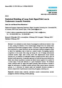
Comparing radio link for LEO UHF Antenna&
VHF
UHF/VHF
50&cm&+&6&m 50&cm&+&6&m 50&cm&+&6&m
S'Band
Lora
76&mm&(diameter)
10+30&cm
Data&rate ~100&Kbps
~100&Kbps
~100&Kbps
1+2&Mbps
~300&Kbps
Power
0.5&+&2&W
0.5&+&2&W
0.5&+&2&W
3+6&W
100&mW
Distance
~1200&Km
~1200&Km
~1200&Km
~&1200&Km
200+600&Km
8000+9000&USD
8000+9000&USD
90&USD
Cost
→&To&propose&direct&radio&links&between&sensor&fields&and&LEO& satellites&Concurrent&&based&on&the¤t&innovation&solutions& such&as&LoRa&Semtech,&solutions&from&vendors&QB50&etc.& References:& http://www.clyde+space.com/cubesat_shop/communication_systems& http://www.isispace.nl/cms/index.php/products+and+services/products& http://www.digikey.com/product+search/en?mpart=SX1276RF1KAS&vendor=600& http://www.instructables.com/id/Introducing+LoRa+/step19/LoRa+receiver+links/
14
Perspectives Practical feasibility and constraints: low cost, low energy • Design of ground and sky systems • Micro controllers : Arduino, TI, Raspberry, Galileo, NVidia … • Communication transceivers : TI CCxxx, Semtech LoRa, .. More simulation • Including radio links and footprints, satellite speed factor • ground applications for environment monitoring • service simulation several ground clients, several sensor fields • HLA federation, multi languages
15
Thank you
For further informations: http://wsn.univ-brest.fr/pottier
16